[unknown data provider] |
|
Web Map Service INFOMAR
http://spatial.dcenr.gov.ie:80/wmsconnector/com.esri.wms.Esrimap/INFOMAR
| Service health Now: |
|---|
- Interface
- Web Service, OGC Web Map Service 1.1.1
- Keywords
- Elevation,Environmental monitoring facilities,Energy resources,Geology,Habitats and biotopes,Mineral resources,Sea regions,Species distribution,Utility and governmental services,Hydrography,Oceanographic geographical features,Multibeam,Renewable energy development,Coastal engineering and erosion,Coastal zone management,Fishing and offshore aquaculture,oil and gas exploration and exploitation,Sustainable management of marine based activities,Marine safety,MI,Marine Institute,GSI,Geological Survey of Ireland,Integrated Mapping for the Sustainable Development of Ireland's Marine Resource,Irish National Seabed Survey,INSS,INFOMAR,Bathymetry,LIDAR,Laser Interferometry Detection and Ranging,Bord Iascaigh Mhara (BIM), Habitat Mapping for Conservation and Management of the Southern Irish Sea (HabMap) Trinity College Dublin (TCD),Ireland, Northern Ireland and Scotland Hydrographic Survey (INIS Hydro),Irish Sea Marine Aggregates Initiative (IMAGIN), Irish Sea Marine Assessment (ISMA) Gaelectric University College Cork,Joint Irish Bathymetric Survey Project (JIBS),Mapping European Seabed Habitats (MESH), Marine Institute (MI) Nephrops surveys,Methane derived authigenic carbonates (MDAC) National Parks and Wildlife Service (NPWS),OceanEnergy,Petroleum Affairs Division (PAD), Scallop surveys - Bord Iascaigh Mhara (BIM) Coastal and Marine Research Centre (CMRC), SmartBay Ireland,Sustainable Energy Authority of Ireland (SEAI),Tonn Energy,University of Ulster,
- Fees
- Open and free access to all GSI digital data
- Access constraints
- Please reference the INSS/INFOMAR projects when the data is used in presentations or publications.
- Data provider
-
unknown (unverified)
Contact information:
postal:
Ads by Google
ArcIMS 10.0.0 INFOMAR Web Map Service. Please visit http://www.infomar.ie.This area was surveyed as part of the ongoing INFOMAR project (formerly Irish National Seabed Survey), a joint seabed mapping project between the Geological Survey of Ireland and the Marine Institute. Data from associated projects and organisations is also used within this service including Bord Iascaigh Mhara (BIM), Habitat Mapping for Conservation and Management of the Southern Irish Sea (HabMap) Trinity College Dublin (TCD),Ireland, Northern Ireland and Scotland Hydrographic Survey (INIS Hydro),Irish Sea Marine Aggregates Initiative (IMAGIN), Irish Sea Marine Assessment (ISMA) Gaelectric University College Cork,Joint Irish Bathymetric Survey Project (JIBS),Mapping European Seabed Habitats (MESH), Marine Institute (MI) Nephrops surveys,Methane derived authigenic carbonates (MDAC) National Parks and Wildlife Service (NPWS),OceanEnergy,Petroleum Affairs Division (PAD), Scallop surveys - Bord Iascaigh Mhara (BIM) Coastal and Marine Research Centre (CMRC), SmartBay Ireland,Sustainable Energy Authority of Ireland (SEAI),Tonn Energy,University of Ulster, WestWave,
Available map layers (41)
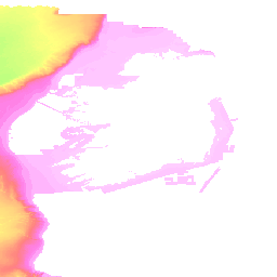
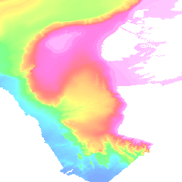
Bathymetry 500M GRID (BATHY_GRID_500)
Bathymetry 111M GRID (BATHY_GRID_111)
Ireland (Ireland)
LIDAR 7M GRID (LIDAR_7M_LAT_WGS)
Bathymetry 500M Shaded Relief (Bathy_500M_SR)
Bathymetry 111M Shaded Relief (Bathy_111M_SR)
Backscatter 10m (Backs_10M)
Bathymetry 20M Shaded Relief (SR_MOSAIC_20M_NE_EARTH)
Seabed Classification Bantry and Dunmanus Bays 10M (SC_BANTRY_DUNMANUS_10M_WGS84)
Seabed Classification Cork Coast 16M (SC_CORK_16M_WGS84)
Seabed Classification East Coast 10M (SC_E_COAST_10M_WGS84)
Seabed Classification Galway Bay 28M (SC_GALWAY_28M_WGS84)
Seabed Classification Donegal and Sligo Bays 19M (SC_DL_SO_19M_WGS84)
Seabed Classification Waterford Coast 5M (SC_WATERFORD_5M_WGS84)
Seabed Classification Wexford Coast 15M (SC_WEXFORD_15M_WGS84)
Zones (50m-5000m) (ZONES_WGS84)
Irish Designated Zone (IDZ)
PAD1996 foot of slope survey (PAD)
Survey 2014 (2014)
Survey 2013 (2013)
Survey 2012 (2012)
Survey 2011 (2011)
Survey 2010 (2010)
Survey 2009 (2009)
Survey 2008 (2008)
Survey 2007 (2007)
Survey 2006 (2006)
Survey 2005 (2005)
Survey 2004 (2004)
Survey 2003 (2003)
Survey 2002 (2002)
Survey 2001 (2001)
Survey 2000 (2000)
Sound Velocity Profile Points (SVP)
Grab Sample Locations (INFO_GRAB_SAMPLES)
New Priority Areas (priority_areas)
New Priority Bays (26_Bays)
Non INFOMAR INSS Data Coverage (nonINFOMAR)
Survey Coverage 2003 to 2014 (Coverage)
LIDAR Data Coverage (Lidar)
Shipwreck Database (SHIPWRECKS)
There are currently no notifications for the service, click the feed icon to subscribe.