Service public de Wallonie |
|
WALOUS_OCCUPATION_SOL
| Service health Now: |
|---|
- Interface
- Web Service, OGC Web Map Service 1.3.0
- Keywords
- Occupation du sol, 2018, WALOUS, Land Cover
- Fees
- unknown
- Access constraints
- unknown
- Supported languages
- No INSPIRE Extended Capabilities (including service language support) given. See INSPIRE Technical Guidance - View Services for more information.
- Data provider
-
Service public de Wallonie (unverified)
Contact information:
Service public de Wallonie
Namur, Belgium
Email:
- Service metadata
- No INSPIRE Extended Capabilities (including service metadata) given. See INSPIRE Technical Guidance - View Services for more information.
Ads by Google
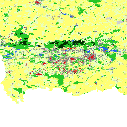
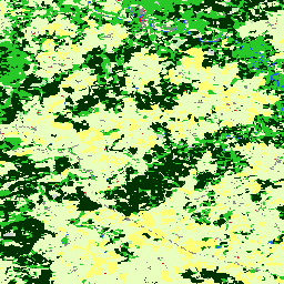
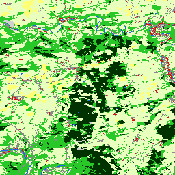
Ce service de visualisation permet de consulter la Carte matricielle d'occupation du sol en Wallonie pour l'année 2018
Available map layers (1)
Occupation du sol en Wallonie - WALOUS 2018 (0)
Cette couche de données reprend la cartographie de l’occupation du sol de l’ensemble du territoire wallon pour l’année 2018. Pour plus d'informations sur cette donnée, consultez http://geoportail.wallonie.be/catalogue/a0ad23a1-1845-4bd5-8c2f-0f62d3f1ec75.html
There are currently no notifications for the service, click the feed icon to subscribe.