Kartverket |
|
Hydrography : Physical Waters
| Service health Now: |
|---|
- Interface
- Web Service, OGC Web Map Service 1.3.0
- Keywords
- ExM:ViewService, inlandWaters, infoMapAccessService
- Fees
- None
- Access constraints
- None
- Supported languages
- eng , nor
- Data provider
-
Kartverket (unverified)
Contact information:
Thomas Ellett von Brasch
Kartverket
Postal address:
Statens kartverk, 3507 Hønefoss, NorwayEmail:
Phone: +47 32 11 81 00
- Service metadata
Hydrography in the context of this data specification is involved with the description of the sea, lakes, rivers and other waters, with their phenomena and all hydrographic-related elements. For mapping purposes, it includes a representation of physical elements – both natural and artificial. For reporting requirements of EC water-related directives it includes WFD surface water bodies. For spatial analysis and modelling, it includes a topologically-sound network of rivers and canals.
Available map layers (10)
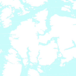
Hydrography : Physical Waters (HY.PhysicalWaters)
Hydrography in the context of this data specification is involved with the description of the sea, lakes, rivers and other waters, with their phenomena and all hydrographic-related elements. For mapping purposes, it includes a representation of physical elements – both natural and artificial. For reporting requirements of EC water-related directives it includes WFD surface water bodies. For spatial analysis and modelling, it includes a topologically-sound network of rivers and canals.
Man-made Object (HY.PhysicalWaters.ManMadeObject)
A man-made object is either a feature of type Crossing, DamOrWeir, Sluice, Lock, Ford or ShorelineConstruction.
Hydrography : Physical Waters : Dam Or Weir (HY.PhysicalWaters.DamOrWeir)
An artificial object which lies inside a body of water and has one of the following types of function: - Retains the water; - Regulates the quantity of water; - Alters the course of the water; - Allows watercourses to cross each other.
Hydrography : Physical Waters : Shoreline Construction (HY.PhysicalWaters.ShorelineConstruction)
Land water boundary (HY.PhysicalWaters.LandWaterBoundary)
The line where a land mass is in contact with a body of water.
Hydrography : Physical Waters : Land water Boundary (Large.HY.PhysicalWaters.LandWaterBoundary)
The line where a land mass is in contact with a body of water.
Hydrography : Physical Waters : Land water Boundary (Medium.HY.PhysicalWaters.LandWaterBoundary)
The line where a land mass is in contact with a body of water.
Waterbody (HY.PhysicalWaters.Waterbodies)
A waterbody is either a feature of type Watercourse or StandingWater.
Ocean Region (HY.OceanRegion)
One of the three large regions of the world-wide ocean, each with associated sub- and marginal areas and subject to an independent flow-regime.
The Hydrography Theme : OceanRegion : MediumScale (HY.Medium.OceanRegion)