Land & Property Services |
|
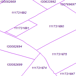
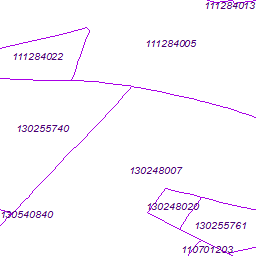
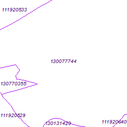
Cadastral Parcels NI (INSPIRE View Service)
| Service health Now: |
|---|
- Interface
- Web Service, OGC Web Map Service 1.3.0
- Keywords
- INSPIRE:ViewService, WMS, INSPIRE, ViewService, infoMapAccessService, Cadastral Parcels, Land Registry, Cadastral parcels
- Fees
- conditions apply
- Access constraints
- Conditions apply
- Supported languages
- eng
- Data provider
-
Land & Property Services (unverified)
Contact information:
Land & Property Services
Land & Property Services
Postal Address:
Lincoln Building 27 - 45 Great Victoria Street Malone Lower, BT2 7SL Belfast, Northern IrelandEmail:
Phone: [your telephone number]
- Service metadata
Ads by Google
Freehold Land Ownership Boundaries - The dataset contains the boundaries of each individual freehold title to land
Available map layers (1)
Cadastral Parcels (Cadastral_Parcels)
Layer Cadastral Parcels
There are currently no notifications for the service, click the feed icon to subscribe.