Arizona Geological Survey |
|
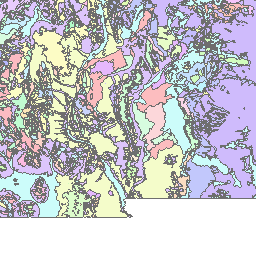
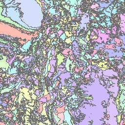
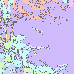
Geologic Map of New Mexico
http://services.azgs.az.gov/arcgis/services/OneGeology/AZGS_NMBGMR_Geology/MapServer/WmsServer
| Service health Now: |
|---|
- Interface
- Web Service, OGC Web Map Service 1.3.0
- Keywords
- WMS, geographicarea@United States, continent@Northern America, subarea@New Mexico, dataprovider@USGIN, serviceprovider@Arizona Geological Survey, Geoserver, Geology, Geologic Map, GeoSciML, onegeology, MD_DATE@2014-01-17, MD_LANG@eng, Geosciml_portrayal_age_or_litho_queryable
- Fees
- none
- Access constraints
- none
- Supported languages
- No INSPIRE Extended Capabilities (including service language support) given. See INSPIRE Technical Guidance - View Services for more information.
- Data provider
-
Arizona Geological Survey (unverified)
Contact information:
Geoinformatics
Arizona Geological Survey
Postal:
416 W Congress St. Ste 10, 85701 Tucson, USAEmail:
Phone: 520-770-3500
- Service metadata
- No INSPIRE Extended Capabilities (including service metadata) given. See INSPIRE Technical Guidance - View Services for more information.
New Mexico Bureau of Geology and Mineral Resources (NMBGMR), as part of the United States Geoscience Information Network (USGIN), is happy to provide our state geologic map published in 2003 ( http://geoinfo.nmt.edu/publications/maps/geologic/state/). This Service was published by the Arizona Geological Survey (AZGS) as part of the USGIN initiative to “create and facilitate discovery and access to geoscience information provided by state and federal geological surveys of the United States”. This data was compiled by the New Mexico Bureau of Geology and is being served by the AZGS on an interim basis. Five (5) layers are included in this service: 1 US-NM_NMBG_500k_Contacts is a compilation dataset containing geologic contacts for the state of New Mexico at a scale of 1:500,000; the table includes contact type, positional accuracy and generic symbolizer (FGDC). Citations are included in the data set. 2. US-NM_NMBGMR_500k_Faults is a compilation dataset containing shear displacement structures for the state of New Mexico at a scale of 1:500,000; the table includes fault type, positional accuracy, and generic symbolizer (FGDC). Citations are included in the dataset. 3. US-NM_NMBGMR_500k_Geologic_Ageis a compilation dataset containing geologic units covering the state of New Mexico at a scale of 1:500,000; the table includes geologic name, description, lithology, and geologic history. The data in this layer is portrayed based on geologic age. 4. US-NM_NMBGMR_500k_Lithology is a compilation dataset containing geologic units covering the state of New Mexico at a scale of 1:500,000; the table includes geologic name, description, lithology, and geologic history. The data in this layer is portrayed based on lithology. 5. US-NM_NMBGMR_500k_Lithostratigraphy is a compilation dataset containing geologic units covering the state of New Mexico at a scale of 1:500,000; the table includes geologic name, description, lithology, and geologic history. The data in this layer is portrayed based on lithostratigraphic relationships.
Available map layers (6)
AZGS NMBGMR Geology (AZGS_NMBGMR_Geology)
US-NM NMBGMR 1:500k Lithostratigraphy (US-NM_NMBGMR_500k_Lithostratigraphy)
US-NM_NMBGMR_500k_Lithostratigraphy is a compilation dataset containing geologic units covering the state of New Mexico at a scale of 1:500,000; the table includes geologic name, description, lithology, and geologic history. The data in this layer is portrayed based on lithostratigraphic relationships.
US-NM NMBGMR 1:500k Lithology (US-NM_NMBGMR_500k_Lithology)
US-NM_NMBGMR_500k_Lithology is a compilation dataset containing geologic units covering the state of New Mexico at a scale of 1:500,000; the table includes geologic name, description, lithology, and geologic history. The data in this layer is portrayed based on lithology.
US-NM NMBGMR 1:500k Geologic Age (US-NM_NMBGMR_500k_Geologic_Age)
US-NM_NMBGMR_500k_Geologic_Age is a compilation dataset containing geologic units covering the state of New Mexico at a scale of 1:500,000; the table includes geologic name, description, lithology, and geologic history.The data in this layer is portrayed based on geologic age.
US-NM NMBGMR 1:500k Faults (US-NM_NMBGMR_500k_Faults)
US-NM_NMBGMR_500k_Faults is a compilation dataset containing shear displacement structures for the state of New Mexico at a scale of 1:500,000; the table includes fault type, positional accuracy, and generic symbolizer (FGDC). Citations are included in the dataset.
US-NM NMBGMR 1:500k Contacts (US-NM_NMBGMR_500k_Contacts)
US-NM_NMBG_500k_Contacts is a compilation dataset containing geologic contacts for the states of New Mexico at a scale of 1:500,000; the table includes contact type, positional accuracy and generic symbolizer (FGDC). Citations are included in the data set.