N4M5 |
|
EMODnet Bathymetry WMS

| Service health Now: |
|---|
- Interface
- Web Service, OGC Web Map Service 1.3.0
- Keywords
- Fees
- None
- Access constraints
- None
- Supported languages
- eng
- Data provider
-
N4M5 (unverified)
Contact information:
Niels Meijer
N4M5
Bunnik, The Netherlands
Email:
- Service metadata
Ads by Google
Available map layers (16)
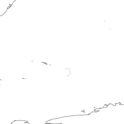
Coastlines (coastlines)
Coastlines of Europe
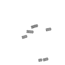
Depth contours (emodnet:contours)
Generalised bathymetric contour lines. (50, 100, 200, 500, 1000, 2000, 5000 meter interval)
Bathymetry product tiles (emodnet:download_tiles)
Download schema for Bathymetry products tiles (most recent release)
High resolution bathymetric data (emodnet:hr_bathymetry_area)
Layer with EMODnet bathymetry show case areas available in a higher resolution than 1/16 arc minute
Mean depth (emodnet:mean)
Mean depth based on source resolution of 1/16 arc minute (~125 meter). Ocean overlay without land cover.
Mean depth (DTM release 2016) (emodnet:mean_2016)
Mean depth based on source resolution of 1/8 arc minute (~250 meter). Ocean overlay without land cover.
Mean depth (DTM release 2018) (emodnet:mean_2018)
Mean depth based on source resolution of 1/16 arc minute (~125 meter). Ocean overlay without land cover.
Mean depth (DTM release 2020) (emodnet:mean_2020)
Mean depth based on source resolution of 1/16 arc minute (~125 meter). Ocean overlay without land cover.
Mean depth (DTM release 2022) (emodnet:mean_2022)
Mean depth based on source resolution of 1/16 arc minute (~125 meter). Ocean overlay without land cover.
Mean depth full coverage with land coverage (emodnet:mean_atlas_land)
Mean depth based on source resolution of 1/16 arc minute (~125 meter). Full coverage ocean and land DTM in traditional atlas style colours.
Mean depth in multi colour (emodnet:mean_multicolour)
Mean depth based on source resolution of 1/16 arc minute (~125 meter). Ocean overlay without land cover in multi colour style.
Mean depth rainbow colour ramp (emodnet:mean_rainbowcolour)
Mean depth based on source resolution of 1/16 arc minute (~125 meter). Ocean overlay without land cover in rainbow (multi) colour ramp style.
Quality index (emodnet:quality_index)
Representation of various quality indicators for the individual bathymetric surveys and composite DTM’s that contribute to the EMODnet Bathymetry DTM
Sea names (world:sea_names)
Maintained and provided by SeaDataNet
Source references (emodnet:source_references)
Coverage of individual bathymetric surveys and Composite DTMs that contribute to the EMODnet Bathymetry DTM.
undersea_features (gebco:undersea_features)
There are currently no notifications for the service, click the feed icon to subscribe.