OSGeo |
|
GeoServer Web Map Service
| Service health Now: |
|---|
- Interface
- Web Service, OGC Web Map Service 1.3.0
- Keywords
- WMS, GEOSERVER
- Fees
- NONE
- Access constraints
- NONE
- Supported languages
- No INSPIRE Extended Capabilities (including service language support) given. See INSPIRE Technical Guidance - View Services for more information.
- Data provider
-
OSGeo (unverified)
Contact information:
Claudius Ptolomaeus
OSGeo
Work:
Alexandria, Roman EmpireEmail:
- Service metadata
- No INSPIRE Extended Capabilities (including service metadata) given. See INSPIRE Technical Guidance - View Services for more information.
A compliant implementation of WMS plus most of the SLD extension (dynamic styling). Can also generate PDF, SVG, KML, GeoRSS
Available map layers (80)
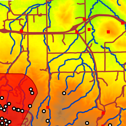
Spearfish (spearfish)
Spearfish City in Lawrence County, South Dakota The area covered by the data set is in the vicinity of Spearfish and includes a majority of the Black Hills National Forest (i.e., Mount Rushmore).
Tasmania (tasmania)
Tasmania Australia from Digital Chart of the World.
TIGER New York (tiger-ny)
Topologically Integrated Geographic Encoding and Referencing (TIGER) dataset for New York.
World Map (ne:world)
World map constructed with Natural Earth countries, boundaries and populated places.
Countries (ne:countries)
Country boundaries on land and offshore.
Disputed Areas (ne:disputed_areas)
Disputed areas and breakaway regions.
Coastlines (ne:coastlines)
Ocean coastline, including major islands.
Boundary Lines (ne:boundary_lines)
Country boundaries on land and offshore.
Populated Places (ne:populated_places)
City and town points
A sample ArcGrid file (nurc:Arc_Sample)
HELCOM subbasins 2013 (ices_ref:HELCOM subbasins 2013)
HELCOM_subbasins_2013_WGS (ices_ref:HELCOM_subbasins_2013_WGS)
ICES_AREAS_VISA_SIMPLE_5KM (ices_eg:ICES_AREAS_VISA_SIMPLE_5KM)
ICES_Advice_2005 (ices_eg:ICES_Advice_2005)
ICES_Advice_2007 (ices_eg:ICES_Advice_2007)
ICES_Advice_2008 (ices_eg:ICES_Advice_2008)
ICES_Advice_2011 (ices_eg:ICES_Advice_2011)
ICES_Advice_2012 (ices_eg:ICES_Advice_2012)
ICES_Advice_2013 (ices_eg:ICES_Advice_2013)
ICES_Advice_2014 (ices_eg:ICES_Advice_2014)
ICES_Areas_20051103 (ices_ref:ICES_Areas_20051103)
ICES_ecoregions_ESRI_cut_20150113 (ices_ref:ICES_ecoregions_ESRI_cut_20150113)
North America sample imagery (nurc:Img_Sample)
NAFO (ices_eg:NAFO)
NEAFC (ices_eg:NEAFC)
NEAFC_Closed_Areas_2005 (ices_eg:NEAFC_Closed_Areas_2005)
NEAFC_Closed_Areas_2007 (ices_eg:NEAFC_Closed_Areas_2007)
NEAFC_Closed_Areas_2008 (ices_eg:NEAFC_Closed_Areas_2008)
NEAFC_Closed_Areas_2009 (ices_eg:NEAFC_Closed_Areas_2009)
NEAFC_Closed_Areas_2010 (ices_eg:NEAFC_Closed_Areas_2010)
NEAFC_Closed_Areas_2013 (ices_eg:NEAFC_Closed_Areas_2013)
NEAFC_Closed_Areas_2014 (ices_eg:NEAFC_Closed_Areas_2014)
NEAFC_Closed_Areas_2015 (ices_eg:NEAFC_Closed_Areas_2015)
NEAFC_Fishing_Areas (ices_eg:NEAFC_Fishing_Areas)
NEAFC_RA_Official (ices_eg:NEAFC_RA_Official)
NEAFC_existing_fishing_areas_from_2015 (ices_eg:NEAFC_existing_fishing_areas_from_2015)
NEAFC_existing_fishing_areas_pre2015 (ices_eg:NEAFC_existing_fishing_areas_pre2015)
ODIMS_UnderwaterNoiseIndicatorPulseBlockDaysPerICESSubSquare_2014 (ices_eg:ODIMS_UnderwaterNoiseIndicatorPulseBlockDaysPerICESSubSquare_2014)
ODIMS_UnderwaterNoiseIndicatorPulseBlockDaysPerICESSubSquare_2015 (ices_eg:ODIMS_UnderwaterNoiseIndicatorPulseBlockDaysPerICESSubSquare_2015)
ODIMS_UnderwaterNoiseIndicatorPulseBlockDaysPerICESSubSquare_2016 (ices_eg:ODIMS_UnderwaterNoiseIndicatorPulseBlockDaysPerICESSubSquare_2016)
ODIMS_UnderwaterNoiseIndicatorPulseBlockDaysPerICESSubSquare_2019 (ices_eg:ODIMS_UnderwaterNoiseIndicatorPulseBlockDaysPerICESSubSquare_2019)
ODIMS_UnderwaterNoiseIndicatorPulseBlockDaysPerICESSubSquare_2021 (ices_eg:ODIMS_UnderwaterNoiseIndicatorPulseBlockDaysPerICESSubSquare_2021)
ODIMS_UnderwaterNoiseIndicator_2014 (ices_eg:ODIMS_UnderwaterNoiseIndicator_2014)
ODIMS_UnderwaterNoiseIndicator_2016 (ices_eg:ODIMS_UnderwaterNoiseIndicator_2016)
ODIMS_UnderwaterNoiseIndicator_2017 (ices_eg:ODIMS_UnderwaterNoiseIndicator_2017)
ODIMS_UnderwaterNoiseIndicator_2018 (ices_eg:ODIMS_UnderwaterNoiseIndicator_2018)
ODIMS_UnderwaterNoiseIndicator_2019 (ices_eg:ODIMS_UnderwaterNoiseIndicator_2019)
ODIMS_UnderwaterNoiseIndicator_2020 (ices_eg:ODIMS_UnderwaterNoiseIndicator_2020)
ODIMS_UnderwaterNoiseIndicator_2021 (ices_eg:ODIMS_UnderwaterNoiseIndicator_2021)
ODIMS_UnderwaterNoiseIndicator_2022 (ices_eg:ODIMS_UnderwaterNoiseIndicator_2022)
OSPAR_regions_20091214 (ices_ref:OSPAR_regions_20091214)
Pk50095 (nurc:Pk50095)
Pk50095 is a raster file accompanied by a spatial data file.
WGDEC_Rec2005 (ices_eg:WGDEC_Rec2005)
WGDEC_Rec2007 (ices_eg:WGDEC_Rec2007)
WGDEC_Rec2008 (ices_eg:WGDEC_Rec2008)
WGDEC_Rec2011 (ices_eg:WGDEC_Rec2011)
WGDEC_Rec2012 (ices_eg:WGDEC_Rec2012)
WGDEC_Rec2013 (ices_eg:WGDEC_Rec2013)
WGDEC_Rec2014 (ices_eg:WGDEC_Rec2014)
Spearfish archeological sites (sf:archsites)
Sample data from GRASS, archeological sites location, Spearfish, South Dakota, USA
Spearfish bug locations (sf:bugsites)
Sample data from GRASS, bug sites location, Spearfish, South Dakota, USA
World rectangle (tiger:giant_polygon)
A simple rectangular polygon covering most of the world, it's only used for the purpose of providing a background (WMS bgcolor could be used instead)
gs_CHASE_result_2021 (HHAT:gs_CHASE_result_2021)
gs_CHASE_result_L2_pie_2021 (HHAT:gs_CHASE_result_L2_pie_2021)
gs_results_indicators (HHAT:gs_results_indicators)
mosaic (nurc:mosaic)
Italian sample mosaic
Manhattan (NY) points of interest (tiger:poi)
Points of interest in New York, New York (on Manhattan). One of the attributes contains the name of a file with a picture of the point of interest.
Manhattan (NY) landmarks (tiger:poly_landmarks)
Manhattan landmarks, identifies water, lakes, parks, interesting buildilngs
Spearfish restricted areas (sf:restricted)
Sample data from GRASS, restricted areas, Spearfish, South Dakota, USA
Spearfish roads (sf:roads)
Sample data from GRASS, road layout, Spearfish, South Dakota, USA
Spearfish elevation (sf:sfdem)
Digital elevation model for the Spearfish region. sfdem is a Tagged Image File Format with Geographic information
USA Population (topp:states)
This is some census data on the states.
Spearfish streams (sf:streams)
Sample data from GRASS, streams, Spearfish, South Dakota, USA
Tasmania cities (topp:tasmania_cities)
Cities in Tasmania (actually, just the capital)
Tasmania roads (topp:tasmania_roads)
Main Tasmania roads
Tasmania state boundaries (topp:tasmania_state_boundaries)
Tasmania state boundaries
Tasmania water bodies (topp:tasmania_water_bodies)
Tasmania water bodies
Manhattan (NY) roads (tiger:tiger_roads)
Highly simplified road layout of Manhattan in New York..
vw_getNoiseDataLayer_All (ices_eg:vw_getNoiseDataLayer_All)
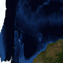
world-topo-bathy-200407-3x8640x4320 (ext_ref:world-topo-bathy-200407-3x8640x4320)