Earth Observation Center (EOC), DLR |
|
EOC Land Map Service
| Service health Now: |
|---|
- Interface
- Web Service, OGC Web Map Service 1.3.0
- Keywords
- DLR, EOC, Germany, Global Urban Footprint, GUF, CORINE, CORINE_1990, CORINE_2000, CORINE_2006, Land cover, Global SnowPack, GSP
- Fees
- NONE
- Access constraints
- NONE
- Supported languages
- No INSPIRE Extended Capabilities (including service language support) given. See INSPIRE Technical Guidance - View Services for more information.
- Data provider
-
Earth Observation Center (EOC), DLR (unverified)
Contact information:
Geoservice Manager
Earth Observation Center (EOC), DLR
Postal:
Münchener Straße 20, 82234 Weßling, GermanyEmail:
- Service metadata
- No INSPIRE Extended Capabilities (including service metadata) given. See INSPIRE Technical Guidance - View Services for more information.
This Web Map Service provides access to land coverage products within the Earth Observation Center (EOC).
Available map layers (130)
CORINE Land Cover 1990 1000m x 1000m ETRS89 (CORINE_LAND_COVER_1990_1000x1000_ETRS89)
The objective of the pan-European project CORINE Land Cover (CLC) is the provision of a unique and comparable data set of land cover for Europe and the delivery of regular updates to register also the land cover and land use changes over time. It is part of the European Union programme CORINE (Coordination of Information on the Environment). The mapping of the land cover and land use was performed on the basis of satellite remote sensing images. The first CLC data base CLC1990, which was finalized in the 1990s, consistently provided land use information comprising 44 classes, out of which 37 classes are relevant in Germany. The first two updates for Europe were based on the reference years 2000 and 2006. For Germany, DLR-DFD was responsible for the creation of CLC2000 and CLC2006 on behalf of the Federal Environment Agency. In addition to the updated land cover, change datasets were also parts of the project. For deriving a meaningful CLC2000 change product, it became necessary to re-interprete parts of the satellite data of 1990 and to create a revised product, called CLC1990 (rev).
CORINE Land Cover 1990 1000m x 1000m LAEA (CORINE_LAND_COVER_1990_1000x1000_LAEA)
The objective of the pan-European project CORINE Land Cover (CLC) is the provision of a unique and comparable data set of land cover for Europe and the delivery of regular updates to register also the land cover and land use changes over time. It is part of the European Union programme CORINE (Coordination of Information on the Environment). The mapping of the land cover and land use was performed on the basis of satellite remote sensing images. The first CLC data base CLC1990, which was finalized in the 1990s, consistently provided land use information comprising 44 classes, out of which 37 classes are relevant in Germany. The first two updates for Europe were based on the reference years 2000 and 2006. For Germany, DLR-DFD was responsible for the creation of CLC2000 and CLC2006 on behalf of the Federal Environment Agency. In addition to the updated land cover, change datasets were also parts of the project. For deriving a meaningful CLC2000 change product, it became necessary to re-interprete parts of the satellite data of 1990 and to create a revised product, called CLC1990 (rev).
CORINE Land Cover 1990 100m x 100m ETRS89 (CORINE_LAND_COVER_1990_100x100_ETRS89)
The objective of the pan-European project CORINE Land Cover (CLC) is the provision of a unique and comparable data set of land cover for Europe and the delivery of regular updates to register also the land cover and land use changes over time. It is part of the European Union programme CORINE (Coordination of Information on the Environment). The mapping of the land cover and land use was performed on the basis of satellite remote sensing images. The first CLC data base CLC1990, which was finalized in the 1990s, consistently provided land use information comprising 44 classes, out of which 37 classes are relevant in Germany. The first two updates for Europe were based on the reference years 2000 and 2006. For Germany, DLR-DFD was responsible for the creation of CLC2000 and CLC2006 on behalf of the Federal Environment Agency. In addition to the updated land cover, change datasets were also parts of the project. For deriving a meaningful CLC2000 change product, it became necessary to re-interprete parts of the satellite data of 1990 and to create a revised product, called CLC1990 (rev).
CORINE Land Cover 1990 100m x 100m LAEA (CORINE_LAND_COVER_1990_100x100_LAEA)
The objective of the pan-European project CORINE Land Cover (CLC) is the provision of a unique and comparable data set of land cover for Europe and the delivery of regular updates to register also the land cover and land use changes over time. It is part of the European Union programme CORINE (Coordination of Information on the Environment). The mapping of the land cover and land use was performed on the basis of satellite remote sensing images. The first CLC data base CLC1990, which was finalized in the 1990s, consistently provided land use information comprising 44 classes, out of which 37 classes are relevant in Germany. The first two updates for Europe were based on the reference years 2000 and 2006. For Germany, DLR-DFD was responsible for the creation of CLC2000 and CLC2006 on behalf of the Federal Environment Agency. In addition to the updated land cover, change datasets were also parts of the project. For deriving a meaningful CLC2000 change product, it became necessary to re-interprete parts of the satellite data of 1990 and to create a revised product, called CLC1990 (rev).
CORINE Land Cover 1990 250m x 250m ETRS89 (CORINE_LAND_COVER_1990_250x250_ETRS89)
The objective of the pan-European project CORINE Land Cover (CLC) is the provision of a unique and comparable data set of land cover for Europe and the delivery of regular updates to register also the land cover and land use changes over time. It is part of the European Union programme CORINE (Coordination of Information on the Environment). The mapping of the land cover and land use was performed on the basis of satellite remote sensing images. The first CLC data base CLC1990, which was finalized in the 1990s, consistently provided land use information comprising 44 classes, out of which 37 classes are relevant in Germany. The first two updates for Europe were based on the reference years 2000 and 2006. For Germany, DLR-DFD was responsible for the creation of CLC2000 and CLC2006 on behalf of the Federal Environment Agency. In addition to the updated land cover, change datasets were also parts of the project. For deriving a meaningful CLC2000 change product, it became necessary to re-interprete parts of the satellite data of 1990 and to create a revised product, called CLC1990 (rev).
CORINE Land Cover 1990 250m x 250m LAEA (CORINE_LAND_COVER_1990_250x250_LAEA)
The objective of the pan-European project CORINE Land Cover (CLC) is the provision of a unique and comparable data set of land cover for Europe and the delivery of regular updates to register also the land cover and land use changes over time. It is part of the European Union programme CORINE (Coordination of Information on the Environment). The mapping of the land cover and land use was performed on the basis of satellite remote sensing images. The first CLC data base CLC1990, which was finalized in the 1990s, consistently provided land use information comprising 44 classes, out of which 37 classes are relevant in Germany. The first two updates for Europe were based on the reference years 2000 and 2006. For Germany, DLR-DFD was responsible for the creation of CLC2000 and CLC2006 on behalf of the Federal Environment Agency. In addition to the updated land cover, change datasets were also parts of the project. For deriving a meaningful CLC2000 change product, it became necessary to re-interprete parts of the satellite data of 1990 and to create a revised product, called CLC1990 (rev).
CORINE Land Cover 2000 1000m x 1000m ETRS89 (CORINE_LAND_COVER_2000_1000x1000_ETRS89)
The objective of the pan-European project CORINE Land Cover (CLC) is the provision of a unique and comparable data set of land cover for Europe and the delivery of regular updates to register also the land cover and land use changes over time. It is part of the European Union programme CORINE (Coordination of Information on the Environment). The mapping of the land cover and land use was performed on the basis of satellite remote sensing images. The first CLC data base CLC1990, which was finalized in the 1990s, consistently provided land use information comprising 44 classes, out of which 37 classes are relevant in Germany. The first two updates for Europe were based on the reference years 2000 and 2006. For Germany, DLR-DFD was responsible for the creation of CLC2000 and CLC2006 on behalf of the Federal Environment Agency. In addition to the updated land cover, change datasets were also parts of the project. For deriving a meaningful CLC2000 change product, it became necessary to re-interprete parts of the satellite data of 1990 and to create a revised product, called CLC1990 (rev).
CORINE Land Cover 2000 1000m x 1000m LAEA (CORINE_LAND_COVER_2000_1000x1000_LAEA)
The objective of the pan-European project CORINE Land Cover (CLC) is the provision of a unique and comparable data set of land cover for Europe and the delivery of regular updates to register also the land cover and land use changes over time. It is part of the European Union programme CORINE (Coordination of Information on the Environment). The mapping of the land cover and land use was performed on the basis of satellite remote sensing images. The first CLC data base CLC1990, which was finalized in the 1990s, consistently provided land use information comprising 44 classes, out of which 37 classes are relevant in Germany. The first two updates for Europe were based on the reference years 2000 and 2006. For Germany, DLR-DFD was responsible for the creation of CLC2000 and CLC2006 on behalf of the Federal Environment Agency. In addition to the updated land cover, change datasets were also parts of the project. For deriving a meaningful CLC2000 change product, it became necessary to re-interprete parts of the satellite data of 1990 and to create a revised product, called CLC1990 (rev).
CORINE Land Cover 2000 100m x 100m ETRS89 (CORINE_LAND_COVER_2000_100x100_ETRS89)
The objective of the pan-European project CORINE Land Cover (CLC) is the provision of a unique and comparable data set of land cover for Europe and the delivery of regular updates to register also the land cover and land use changes over time. It is part of the European Union programme CORINE (Coordination of Information on the Environment). The mapping of the land cover and land use was performed on the basis of satellite remote sensing images. The first CLC data base CLC1990, which was finalized in the 1990s, consistently provided land use information comprising 44 classes, out of which 37 classes are relevant in Germany. The first two updates for Europe were based on the reference years 2000 and 2006. For Germany, DLR-DFD was responsible for the creation of CLC2000 and CLC2006 on behalf of the Federal Environment Agency. In addition to the updated land cover, change datasets were also parts of the project. For deriving a meaningful CLC2000 change product, it became necessary to re-interprete parts of the satellite data of 1990 and to create a revised product, called CLC1990 (rev).
CORINE Land Cover 2000 100m x 100m LAEA (CORINE_LAND_COVER_2000_100x100_LAEA)
The objective of the pan-European project CORINE Land Cover (CLC) is the provision of a unique and comparable data set of land cover for Europe and the delivery of regular updates to register also the land cover and land use changes over time. It is part of the European Union programme CORINE (Coordination of Information on the Environment). The mapping of the land cover and land use was performed on the basis of satellite remote sensing images. The first CLC data base CLC1990, which was finalized in the 1990s, consistently provided land use information comprising 44 classes, out of which 37 classes are relevant in Germany. The first two updates for Europe were based on the reference years 2000 and 2006. For Germany, DLR-DFD was responsible for the creation of CLC2000 and CLC2006 on behalf of the Federal Environment Agency. In addition to the updated land cover, change datasets were also parts of the project. For deriving a meaningful CLC2000 change product, it became necessary to re-interprete parts of the satellite data of 1990 and to create a revised product, called CLC1990 (rev).
CORINE Land Cover 2000 250m x 250m ETRS89 (CORINE_LAND_COVER_2000_250x250_ETRS89)
The objective of the pan-European project CORINE Land Cover (CLC) is the provision of a unique and comparable data set of land cover for Europe and the delivery of regular updates to register also the land cover and land use changes over time. It is part of the European Union programme CORINE (Coordination of Information on the Environment). The mapping of the land cover and land use was performed on the basis of satellite remote sensing images. The first CLC data base CLC1990, which was finalized in the 1990s, consistently provided land use information comprising 44 classes, out of which 37 classes are relevant in Germany. The first two updates for Europe were based on the reference years 2000 and 2006. For Germany, DLR-DFD was responsible for the creation of CLC2000 and CLC2006 on behalf of the Federal Environment Agency. In addition to the updated land cover, change datasets were also parts of the project. For deriving a meaningful CLC2000 change product, it became necessary to re-interprete parts of the satellite data of 1990 and to create a revised product, called CLC1990 (rev).
CORINE Land Cover 2000 250m x 250m LAEA (CORINE_LAND_COVER_2000_250x250_LAEA)
The objective of the pan-European project CORINE Land Cover (CLC) is the provision of a unique and comparable data set of land cover for Europe and the delivery of regular updates to register also the land cover and land use changes over time. It is part of the European Union programme CORINE (Coordination of Information on the Environment). The mapping of the land cover and land use was performed on the basis of satellite remote sensing images. The first CLC data base CLC1990, which was finalized in the 1990s, consistently provided land use information comprising 44 classes, out of which 37 classes are relevant in Germany. The first two updates for Europe were based on the reference years 2000 and 2006. For Germany, DLR-DFD was responsible for the creation of CLC2000 and CLC2006 on behalf of the Federal Environment Agency. In addition to the updated land cover, change datasets were also parts of the project. For deriving a meaningful CLC2000 change product, it became necessary to re-interprete parts of the satellite data of 1990 and to create a revised product, called CLC1990 (rev).
CORINE Land Cover 2006 1000m x 1000m ETRS89 (CORINE_LAND_COVER_2006_1000x1000_ETRS89)
The objective of the pan-European project CORINE Land Cover (CLC) is the provision of a unique and comparable data set of land cover for Europe and the delivery of regular updates to register also the land cover and land use changes over time. It is part of the European Union programme CORINE (Coordination of Information on the Environment). The mapping of the land cover and land use was performed on the basis of satellite remote sensing images. The first CLC data base CLC1990, which was finalized in the 1990s, consistently provided land use information comprising 44 classes, out of which 37 classes are relevant in Germany. The first two updates for Europe were based on the reference years 2000 and 2006. For Germany, DLR-DFD was responsible for the creation of CLC2000 and CLC2006 on behalf of the Federal Environment Agency. In addition to the updated land cover, change datasets were also parts of the project. For deriving a meaningful CLC2000 change product, it became necessary to re-interprete parts of the satellite data of 1990 and to create a revised product, called CLC1990 (rev).
CORINE Land Cover 2006 1000m x 1000m LAEA (CORINE_LAND_COVER_2006_1000x1000_LAEA)
The objective of the pan-European project CORINE Land Cover (CLC) is the provision of a unique and comparable data set of land cover for Europe and the delivery of regular updates to register also the land cover and land use changes over time. It is part of the European Union programme CORINE (Coordination of Information on the Environment). The mapping of the land cover and land use was performed on the basis of satellite remote sensing images. The first CLC data base CLC1990, which was finalized in the 1990s, consistently provided land use information comprising 44 classes, out of which 37 classes are relevant in Germany. The first two updates for Europe were based on the reference years 2000 and 2006. For Germany, DLR-DFD was responsible for the creation of CLC2000 and CLC2006 on behalf of the Federal Environment Agency. In addition to the updated land cover, change datasets were also parts of the project. For deriving a meaningful CLC2000 change product, it became necessary to re-interprete parts of the satellite data of 1990 and to create a revised product, called CLC1990 (rev).
CORINE Land Cover 2006 100m x 100m ETRS89 (CORINE_LAND_COVER_2006_100x100_ETRS89)
The objective of the pan-European project CORINE Land Cover (CLC) is the provision of a unique and comparable data set of land cover for Europe and the delivery of regular updates to register also the land cover and land use changes over time. It is part of the European Union programme CORINE (Coordination of Information on the Environment). The mapping of the land cover and land use was performed on the basis of satellite remote sensing images. The first CLC data base CLC1990, which was finalized in the 1990s, consistently provided land use information comprising 44 classes, out of which 37 classes are relevant in Germany. The first two updates for Europe were based on the reference years 2000 and 2006. For Germany, DLR-DFD was responsible for the creation of CLC2000 and CLC2006 on behalf of the Federal Environment Agency. In addition to the updated land cover, change datasets were also parts of the project. For deriving a meaningful CLC2000 change product, it became necessary to re-interprete parts of the satellite data of 1990 and to create a revised product, called CLC1990 (rev).
CORINE Land Cover 2006 100m x 100m LAEA (CORINE_LAND_COVER_2006_100x100_LAEA)
The objective of the pan-European project CORINE Land Cover (CLC) is the provision of a unique and comparable data set of land cover for Europe and the delivery of regular updates to register also the land cover and land use changes over time. It is part of the European Union programme CORINE (Coordination of Information on the Environment). The mapping of the land cover and land use was performed on the basis of satellite remote sensing images. The first CLC data base CLC1990, which was finalized in the 1990s, consistently provided land use information comprising 44 classes, out of which 37 classes are relevant in Germany. The first two updates for Europe were based on the reference years 2000 and 2006. For Germany, DLR-DFD was responsible for the creation of CLC2000 and CLC2006 on behalf of the Federal Environment Agency. In addition to the updated land cover, change datasets were also parts of the project. For deriving a meaningful CLC2000 change product, it became necessary to re-interprete parts of the satellite data of 1990 and to create a revised product, called CLC1990 (rev).
CORINE Land Cover 2006 250m x 250m ETRS89 (CORINE_LAND_COVER_2006_250x250_ETRS89)
The objective of the pan-European project CORINE Land Cover (CLC) is the provision of a unique and comparable data set of land cover for Europe and the delivery of regular updates to register also the land cover and land use changes over time. It is part of the European Union programme CORINE (Coordination of Information on the Environment). The mapping of the land cover and land use was performed on the basis of satellite remote sensing images. The first CLC data base CLC1990, which was finalized in the 1990s, consistently provided land use information comprising 44 classes, out of which 37 classes are relevant in Germany. The first two updates for Europe were based on the reference years 2000 and 2006. For Germany, DLR-DFD was responsible for the creation of CLC2000 and CLC2006 on behalf of the Federal Environment Agency. In addition to the updated land cover, change datasets were also parts of the project. For deriving a meaningful CLC2000 change product, it became necessary to re-interprete parts of the satellite data of 1990 and to create a revised product, called CLC1990 (rev).
CORINE Land Cover 2006 250m x 250m LAEA (CORINE_LAND_COVER_2006_250x250_LAEA)
The objective of the pan-European project CORINE Land Cover (CLC) is the provision of a unique and comparable data set of land cover for Europe and the delivery of regular updates to register also the land cover and land use changes over time. It is part of the European Union programme CORINE (Coordination of Information on the Environment). The mapping of the land cover and land use was performed on the basis of satellite remote sensing images. The first CLC data base CLC1990, which was finalized in the 1990s, consistently provided land use information comprising 44 classes, out of which 37 classes are relevant in Germany. The first two updates for Europe were based on the reference years 2000 and 2006. For Germany, DLR-DFD was responsible for the creation of CLC2000 and CLC2006 on behalf of the Federal Environment Agency. In addition to the updated land cover, change datasets were also parts of the project. For deriving a meaningful CLC2000 change product, it became necessary to re-interprete parts of the satellite data of 1990 and to create a revised product, called CLC1990 (rev).
CORINE Land Cover Change 2000 100m x 100m ETRS89 (CORINE_LAND_COVER_CHANGE_2000_100x100_ETRS89)
The objective of the pan-European project CORINE Land Cover (CLC) is the provision of a unique and comparable data set of land cover for Europe and the delivery of regular updates to register also the land cover and land use changes over time. It is part of the European Union programme CORINE (Coordination of Information on the Environment). The mapping of the land cover and land use was performed on the basis of satellite remote sensing images. The first CLC data base CLC1990, which was finalized in the 1990s, consistently provided land use information comprising 44 classes, out of which 37 classes are relevant in Germany. The first two updates for Europe were based on the reference years 2000 and 2006. For Germany, DLR-DFD was responsible for the creation of CLC2000 and CLC2006 on behalf of the Federal Environment Agency. In addition to the updated land cover, change datasets were also parts of the project. For deriving a meaningful CLC2000 change product, it became necessary to re-interprete parts of the satellite data of 1990 and to create a revised product, called CLC1990 (rev).
CORINE Land Cover Change 2000 100m x 100m LAEA (CORINE_LAND_COVER_CHANGE_2000_100x100_LAEA)
The objective of the pan-European project CORINE Land Cover (CLC) is the provision of a unique and comparable data set of land cover for Europe and the delivery of regular updates to register also the land cover and land use changes over time. It is part of the European Union programme CORINE (Coordination of Information on the Environment). The mapping of the land cover and land use was performed on the basis of satellite remote sensing images. The first CLC data base CLC1990, which was finalized in the 1990s, consistently provided land use information comprising 44 classes, out of which 37 classes are relevant in Germany. The first two updates for Europe were based on the reference years 2000 and 2006. For Germany, DLR-DFD was responsible for the creation of CLC2000 and CLC2006 on behalf of the Federal Environment Agency. In addition to the updated land cover, change datasets were also parts of the project. For deriving a meaningful CLC2000 change product, it became necessary to re-interprete parts of the satellite data of 1990 and to create a revised product, called CLC1990 (rev).
CORINE Land Cover Change 2006 100m x 100m ETRS89 (CORINE_LAND_COVER_CHANGE_2006_100x100_ETRS89)
The objective of the pan-European project CORINE Land Cover (CLC) is the provision of a unique and comparable data set of land cover for Europe and the delivery of regular updates to register also the land cover and land use changes over time. It is part of the European Union programme CORINE (Coordination of Information on the Environment). The mapping of the land cover and land use was performed on the basis of satellite remote sensing images. The first CLC data base CLC1990, which was finalized in the 1990s, consistently provided land use information comprising 44 classes, out of which 37 classes are relevant in Germany. The first two updates for Europe were based on the reference years 2000 and 2006. For Germany, DLR-DFD was responsible for the creation of CLC2000 and CLC2006 on behalf of the Federal Environment Agency. In addition to the updated land cover, change datasets were also parts of the project. For deriving a meaningful CLC2000 change product, it became necessary to re-interprete parts of the satellite data of 1990 and to create a revised product, called CLC1990 (rev).
CORINE Land Cover Change 2006 100m x 100m LAEA (CORINE_LAND_COVER_CHANGE_2006_100x100_LAEA)
The objective of the pan-European project CORINE Land Cover (CLC) is the provision of a unique and comparable data set of land cover for Europe and the delivery of regular updates to register also the land cover and land use changes over time. It is part of the European Union programme CORINE (Coordination of Information on the Environment). The mapping of the land cover and land use was performed on the basis of satellite remote sensing images. The first CLC data base CLC1990, which was finalized in the 1990s, consistently provided land use information comprising 44 classes, out of which 37 classes are relevant in Germany. The first two updates for Europe were based on the reference years 2000 and 2006. For Germany, DLR-DFD was responsible for the creation of CLC2000 and CLC2006 on behalf of the Federal Environment Agency. In addition to the updated land cover, change datasets were also parts of the project. For deriving a meaningful CLC2000 change product, it became necessary to re-interprete parts of the satellite data of 1990 and to create a revised product, called CLC1990 (rev).
Crop Type Maps Germany, Yearly (CROPTYPES_DE_P1Y)
The layers depict 18 crop types for Germany since 2018 based on Sentinel-1 and Sentinel-2 data with a resolution of 10m.
ESA-CCI Land-Ocean Map (ESA_LAND_OCEAN_MAP)
Land-ocean map derived from ESA CCI Land Cover Dataset.
FCCL Germany, Monthly (FCCL_DE_P1M)
The Forest Canopy Cover Loss (FCCL) shows the forest canopy cover loss in Germany in monthly resolution between September 2017 and September 2024 at 10 m spatial resolution.
FCCL Germany, Observed Changes (FCCL_DE_P1M_CHANGES)
The Forest Canopy Cover Loss (FCCL) monthly observed changes displays how often an observation exceeded a threshold. It is also counted in pixels not labeled as FCCL.
FCCL Germany, Percentage of Gaps (FCCL_DE_P1M_GAPS)
Der Prozentsatz der Lücken in der Waldbedeckung (FCCL) zeigt den Prozentsatz der Lücken (d.h. eine Beobachtung, die einen Schwellenwert nicht überschreitet) in Pixeln, die als FCCL gekennzeichnet sind.
FCCL at Administrative Level, Municipality (FCCL_DE_P1M_GEM)
The layer shows FCCL results aggregated at municipality level. FCCL is quantified separately for deciduous, coniferous, and unclassified forests and the total of all forest types for each month as well as aggregated to annual totals.
FCCL at Administrative Level, District (FCCL_DE_P1M_KRS)
The layer shows FCCL results aggregated at district level. FCCL is quantified separately for deciduous, coniferous, and unclassified forests and the total of all forest types for each month as well as aggregated to annual totals.
FCCL at Administrative Level, Federal State (FCCL_DE_P1M_LAN)
The layer shows FCCL results aggregated at federal state level. FCCL is quantified separately for deciduous, coniferous, and unclassified forests and the total of all forest types for each month as well as aggregated to annual totals.
FCCL Germany, Result Mask (FCCL_DE_P1M_MASK)
Die monatliche Ergebnismaske für den Verlust der Waldbedeckung (Forest Canopy Cover Loss, FCCL) zeigt eine auf Entscheidungsbäumen basierende Klassifizierung der FCCL-Schicht in intakten Wald, (konsistenten) FCCL und zeitliche Veränderungen in Nadel-, Laub- und nicht klassifizierten Wäldern.
FCCL at Pixel Level (FCCL_DE_P1M_VEC)
This layer shows forest canopy cover losses in Germany caused by abiotoc (e.g. storm, fire, hail) and biotoc (e.g. insect infestation, funghi) as well as anthropogenic (e.g. planned harvest, salvage logging, sanitary cuts) drivers at 10 m spatial resolution and at monthly intervals.
Forest Cover Paraguay per District 1986-2020 (FOREST_AREAS_DISTRICTS_PRY_P1Y)
The products shows forest areas in Paraguay per district in ha.
Forest cover changes in the Paraguayan Chaco 1987-2020 (FOREST_COVER_PRY_1986_2020_P1Y)
The products depicts per-pixel forest cover for Paraguay in 30 m spatial resolution from 1986 till 2020.
Forest Structure - Total Canopy Cover (FOREST_COVER_S2_PRY)
Forest Structure - Foliage Height Diversity Index (FOREST_FHD_S2_PRY)
Forest Fragmentation 2000 (FOREST_FRAGMENTATION_PRY_2000)
The product depicts the forest fragmentation in Paraguay for 2020.
Forest Fragmentation 2010 (FOREST_FRAGMENTATION_PRY_2010)
The product depicts the forest fragmentation in Paraguay.
Forest Fragmentation 2020 (FOREST_FRAGMENTATION_PRY_2020)
The product depicts the forest fragmentation in Paraguay.
Forest Structure - Plant Area Index (FOREST_PAI_S2_PRY)
Forest Structure - Canopy Height (95th percentile) (FOREST_RH95_S2_PRY)
Forest Structure Germany - Above-Ground Biomass Density - 2017-2023 (FOREST_STRUCTURE_DE_AGBD_P1Y)
This map shows the Above-ground biomass density (AGBD) in Germany for the years 2017 to 2023
Forest Structure Germany - Canopy Cover - 2017-2023 (FOREST_STRUCTURE_DE_COVER_P1Y)
This map shows the canopy cover in Germany for the years 2017 to 2023
Forest Structure Germany - Canopy Height - 2017-2023 (FOREST_STRUCTURE_DE_RH95_P1Y)
This map shows the canopy height in Germany for the years 2017 to 2023
GrassLands - First Cut (GL_MOW_DE_P1Y_FC)
The layer shows the date of first mowing event in.
GrassLands - Mowing Frequency (GL_MOW_DE_P1Y_FREQ)
The layer shows the number of times grassland is mown per year.
Global SnowPack Snow Cover Duration (GSP_SCD)
Global SnowPack - The arithmetic mean of the Snow Cover Duration Early Season (SCDEmean) (GSP_SCDE_MEAN)
The arithmetic mean of the snow cover duration for early season, which extends from autumn to midwinter (SCDEmean) from 2001 until the current year.
Global SnowPack - Snow Cover Duration Early Season (SCDE) (GSP_SCDE_P1Y)
The snow cover duration for early season, which extends from autumn to midwinter (SCDE).
Global SnowPack - The arithmetic mean of the Snow Cover Duration Late Season (SCDLmean) (GSP_SCDL_MEAN)
The arithmetic mean of the snow cover duration for late season, which extends over the period from mid-winter to the end of summer (SCDLmean) from 2001 until the current year.
Global SnowPack - Snow Cover Duration Late Season (SCDL) (GSP_SCDL_P1Y)
The snow cover duration for late season, which extends over the period from mid-winter to the end of summer (SCDL).
Global SnowPack - The arithmetic mean of the Snow Cover Duration (SCDmean) (GSP_SCD_MEAN)
The arithmetic mean of the snow cover duration for the entire hydrological year (SCDmean) from 2001 until the current year.
Global SnowPack - Snow Cover Duration (SCD) (GSP_SCD_P1Y)
The snow cover duration for the entire hydrological year (SCD).
Global SnowPack - Snow Cover Extent Near Real-Time (SCE NRT) (GSP_SCE_NRT_P1D)
GSP - Global Snowpack Daily - SCE NRT
Global SnowPack - Snow Cover Extent (SCE) (GSP_SCE_P1D)
The snow cover extent (SCE) is the result of the Global SnowPack processor's interpolation steps and all data gaps have been filled.
Global SnowPack - Accuracy (Days-To-Cloudfree) (GSP_XCC10A1_P1D)
The XCC10A1 files show the time distance to the preceding day on which no gap-filling took place. However, these can only be used as a proxy for the overall accuracy, since gaps within the polar night are very likely to have snow cover, but at lower latitudes, the accuracy can drop drastically after just a few days.
GUF04_DLR_v1_Mosaic (for scientific use only) (GUF04_DLR_v1_Mosaic)
This layer represents the Global Urban Footprint® (GUF®) in it's 0.4 arcsecond / ~ 12m resolution version optimized for web service access. The datasets shows two land cover categories: Built-up areas (vertical structures only) are represented with value 255 and non-build-up surfaces with value 0. Areas of no coverage by the satellites are coded as value 128. For small-scale visualisation, reduced resolution overviews have been generated with an interpolation algorithm, that computes the average value of all contribution pixels. See the link to the metadata for more information. GUF® and Global Urban Footprint® are protected as trademarks. A non-exclusive, spatially and temporally unlimited, non-transferable, non-sublicensable right to use GUF is granted free of charge for a) scientific purposes on the high resolution version of GUF® (0.4 arcseconds), b) non-commercial purposes on the low resolution version of the GUF® (2.8 arcseconds). This license does not grant any commercial use of GUF® or products generated or derived by GUF®.
GUF28_DLR_v1_Mosaic (for non-commercial use only) (GUF28_DLR_v1_Mosaic)
This layer represents the Global Urban Footprint® (GUF®) in it's 2.8 arcsecond / ~ 84m resolution version optimized for web service access. The datasets shows two land cover categories: Built-up areas (vertical structures only) are represented with value 255 and non-build-up surfaces with value 0. Areas of no coverage by the satellites are coded as value 128. For small-scale visualisation, reduced resolution overviews have been generated with an interpolation algorithm, that computes the average value of all contribution pixels. See the link to the metadata for more information. GUF® and Global Urban Footprint® are protected as trademarks. A non-exclusive, spatially and temporally unlimited, non-transferable, non-sublicensable right to use GUF is granted free of charge for a) scientific purposes on the high resolution version of GUF® (0.4 arcseconds), b) non-commercial purposes on the low resolution version of the GUF® (2.8 arcseconds). This license does not grant any commercial use of GUF® or products generated or derived by GUF®.
Global WaterPack Monthly (GWP_P1M)
This monthly layer contains information on how often a pixel was detected as open surface water with pixel values between 0 and 31.
Global WaterPack Yearly (GWP_P1Y)
This yearly layer contains information on how often a pixel was detected as open surface water with pixel values between 0 and 365 (366 for leap years).
Hedgerows in Bavaria, 2019-2021 (HEDGEROWS_BY_2019_2021)
The layer shows vectors of hedgerow objects in Bavaria.
IceLines - Sentinel-1 - Monthly (ICELINES_S1_P1M)
IceLines Monthly is an automated calving front monitoring service providing monthly ice shelf front time series of major Antarctic ice shelves.
IceLines - Sentinel-1 - Yearly (ICELINES_S1_P1Y)
IceLines Yearly is an automated calving front monitoring service providing yearly ice shelf front time series of major Antarctic ice shelves.
IceLines - Shelfnames (ICELINES_SHELFNAMES)
The layer depicts the names of each ice shelf.
Input Data Consistency (IDC) Score (IDC_Score)
Input Data Consistency for Landsat data
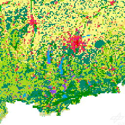
Land Cover DE, 2015 (LCC_DE_2015)
This layer contains a land cover classification of Germany which was created using Sentinel-2 imagery and LUCAS in-situ reference data (https://ec.europa.eu/eurostat/web/lucas). It contains seven land cover types: (1) artificial land, (2) open soil, (3) high seasonal vegetation, (4) high perennial vegetation, (5) low seasonal vegetation, (6) low perennial vegetation and (7) water with a spatial resolution of 10m x 10m.
Noise - Road Traffic Lden (AI Prediction) - Germany, 2017 (N2N_NOISE_AI_DE_2017)
This dataset includes a road traffic noise estimation using ensemble learning and multimodal geodata.
Noise - Road Traffic Lden (2002/49/EC) - Germany, 2017 (N2N_NOISE_DE_2017)
This dataset includes a road traffic noise indicator mapped according to the European Noise Directive (2002/49/EC).
NOAA AVHRR Sea Surface Temperature - Monthly (NOAA_AVHRR_SST_P1M)
"AVHRR - Monthly Sea Surface Temperature (SST)" is an AVHRR (Advanced Very High Resolution Radiometer) subset from 1993 to 2014 integrated to facilitate valuable time series exploitation of historic data. This subset represents the Monthly Average of Sea Surface Temperature in degrees celsius.
Protected Areas in the Paraguayan Chaco (PROTECTED_AREAS_FOREST_PRY)
The products shows protected areas in Paraguay, which receive protection because of their natural values.
Sar4Tectonics - East Eurasia (Ascending) (SAR4TEC_EURASIA_EAST_ASCE)
Sar4Tectonics data for eurasia (Ascending)
Sar4Tectonics - East Eurasia (Descending) (SAR4TEC_EURASIA_EAST_DESC)
Sar4Tectonics data for eurasia (Descending)
SCMaP Exposed Soil Coverage (SCMAP_SC_LS)
Exposed Soil Coverage v1.0 processed by Soil Composite Mapping Processor (SCMaP)
SCMaP Exposed Soil Coverage 1984-2014 (SCMAP_SC_LS_1984-2014)
Exposed Soil Coverage v1.0 for 1984-2014 processed by Soil Composite Mapping Processor (SCMaP)
SCMaP Exposed Soil Frequency (SCMAP_SF_LS)
Exposed Soil Frequency v1.0 processed by Soil Composite Mapping Processor (SCMaP)
SCMaP Exposed Soil Frequency 1984-2014 (SCMAP_SF_LS_1984-2014)
Exposed Soil Frequency v1.0 for 1984-2014 processed by Soil Composite Mapping Processor (SCMaP)
SCMaP Reflectance Soil Composite (SCMAP_SN_LS)
Normalized Reflectance Soil Composite v1.0 processed by Soil Composite Mapping Processor (SCMaP)
SCMaP Reflectance Soil Composite 1984-2014 (normalized) (SCMAP_SN_LS_1984-2014)
Normalized Reflectance Soil Composite v1.0 for 1984-2014 processed by Soil Composite Mapping Processor (SCMaP)
SCMaP Reflectance Composite (SCMAP_SR_LS)
Reflectance Composite v1.0 processed by Soil Composite Mapping Processor (SCMaP)
SCMaP Reflectance Composite 1984-2014 (SCMAP_SR_LS_1984-2014)
Reflectance Composite v1.0 for 1984-2014 processed by Soil Composite Mapping Processor (SCMaP)
SMAP_EURASIA_EAST_ASCE (SMAP_EURASIA_EAST_ASCE)
SoilSuite – Mask, Africa (SOILSUITE_MASK_AFR_P4Y)
The MASK product aggregates simple landcover classes that occur during the time period between 2018 - 2021 (Sentinel-2). The three-class Mask contains: (1) Bare surface occurrences, (2) Permanent vegetation, (3) Other surfaces (e.g. water bodies, urban areas, roads).
SoilSuite – Mask, Europe (SOILSUITE_MASK_EUR_P5Y)
The MASK product aggregates simple landcover classes that occur during the time period between 2018 - 2022 (Sentinel-2). The three-class Mask contains: (1) Bare surface occurrences, (2) Permanent vegetation, (3) Other surfaces (e.g. water bodies, urban areas, roads).
SoilSuite – Reflectance Composite – Standard deviation, Africa (SOILSUITE_MREF-STD_AFR_P4Y)
The Reflectance Composite (Std Dev) contains the standard deviation per band for all valid Sentinel-2 observations between 2018 - 2021, scaled from 0 to 10.000. The valid observations include vegetation, bare surfaces and other surfaces and it excludes clouds, haze, cloud shadows and snow. The product quantifies the spectral dynamic of all landcover types occurring in the images. As an example, it shows a higher standard deviation in agricultural areas compared to natural grasslands.
SoilSuite – Reflectance Composite – Standard deviation, Europe (SOILSUITE_MREF-STD_EUR_P5Y)
The Reflectance Composite (Std Dev) contains the standard deviation per band for all valid Sentinel-2 observations between 2018 - 2022, scaled from 0 to 10.000. The valid observations include vegetation, bare surfaces and other surfaces and it excludes clouds, haze, cloud shadows and snow. The product quantifies the spectral dynamic of all landcover types occurring in the images. As an example, it shows a higher standard deviation in agricultural areas compared to natural grasslands.
SoilSuite – Reflectance Composite, Mean - Africa (SOILSUITE_MREF_AFR_P4Y)
The Reflectance Composte (Mean) contains reflectance values per band, scaled between 0 and 10.000. It represents the mean reflectance of all valid Sentinel-2 observations between 2018 - 2021. Valid observations include vegetation, bare and other surfaces and exclude clouds, haze, cloud shadows and snow.
SoilSuite – Reflectance Composite, Mean - Europe (SOILSUITE_MREF_EUR_P5Y)
The Reflectance Composte (Mean) contains reflectance values per band, scaled between 0 and 10.000. It represents the mean reflectance of all valid Sentinel-2 observations between 2018 - 2022. Valid observations include vegetation, bare and other surfaces and exclude clouds, haze, cloud shadows and snow.
SoilSuite – Bare surface count, Africa (SOILSUITE_SFREQ-BSC_AFR_P4Y)
The Bare Surface Count is defined as the number of occurrences detected as bare surface between 2018 - 2021. It is not normalized to the total number of valid Sentinel-2 observations. The value reveals the dependence of the pixel position across the ground track that can lead to nearly double observations in overlapping orbits.
SoilSuite – Bare surface count, Europe (SOILSUITE_SFREQ-BSC_EUR_P5Y)
The Bare Surface Count is defined as the number of occurrences detected as bare surface between 2018 - 2022. It is not normalized to the total number of valid Sentinel-2 observations. The value reveals the dependence of the pixel position across the ground track that can lead to nearly double observations in overlapping orbits.
SoilSuite – Bare surface frequency, Africa (SOILSUITE_SFREQ-BSF_AFR_P4Y)
The Bare Surface Frequency is scaled between 0 and 1 and quantifies the ratio of bare surface occurrences over the total number of valid Sentinel-2 observations in the observed time period between 2018 - 2021.
SoilSuite – Bare surface frequency, Europe (SOILSUITE_SFREQ-BSF_EUR_P5Y)
The Bare Surface Frequency is scaled between 0 and 1 and quantifies the ratio of bare surface occurrences over the total number of valid Sentinel-2 observations in the observed time period between 2018 - 2022.
SoilSuite – Valid pixel count, Africa (SOILSUITE_SFREQ-VPC_AFR_P4Y)
This Valid Pixel Count contains the total number of valid Sentinel-2 observations in the time period between 2018 - 2021 excluding cloud, haze, cloud shadow, snow, etc..
SoilSuite – Valid pixel count, Europe (SOILSUITE_SFREQ-VPC_EUR_P5Y)
This Valid Pixel Count contains the total number of valid Sentinel-2 observations in the time period between 2018 - 2022 excluding cloud, haze, cloud shadow, snow, etc..
SoilSuite – Bare Surface Reflectance Composite – 95% Confidence, Africa (SOILSUITE_SRC-CI95_AFR_P4Y)
The Bare Surface Reflectance Composite (Std Dev) contains the standard deviation of all Sentinel-2 bare surface reflectance values occuring between 2018 - 2021. It is scaled between 0 and 10.000 for each band and excludes urban areas, water bodies, clouds, haze, cloud shadows and snow. This product quantifies e.g. the spectral dynamic of soils, which might differ according to their physical and chemical properties and thus, can be taken as an additional characteristic of the soil.
SoilSuite – Bare Surface Reflectance Composite – 95% Confidence, Europe (SOILSUITE_SRC-CI95_EUR_P5Y)
The Bare Surface Reflectance Composite (Std Dev) contains the standard deviation of all Sentinel-2 bare surface reflectance values occuring between 2018 - 2022. It is scaled between 0 and 10.000 for each band and excludes urban areas, water bodies, clouds, haze, cloud shadows and snow. This product quantifies e.g. the spectral dynamic of soils, which might differ according to their physical and chemical properties and thus, can be taken as an additional characteristic of the soil.
SoilSuite – Bare Surface Reflectance Composite - Standard deviation, Africa (SOILSUITE_SRC-STD_AFR_P4Y)
The Bare Surface Reflectance Composite (Std Dev) contains the standard deviation of all Sentinel-2 bare surface reflectance values occuring between 2018 - 2021. It is scaled between 0 and 10.000 for each band and excludes urban areas, water bodies, clouds, haze, cloud shadows and snow. This product quantifies e.g. the spectral dynamic of soils, which might differ according to their physical and chemical properties and thus, can be taken as an additional characteristic of the soil.
SoilSuite – Bare Surface Reflectance Composite - Standard deviation, Europe (SOILSUITE_SRC-STD_EUR_P5Y)
The Bare Surface Reflectance Composite (Std Dev) contains the standard deviation of all Sentinel-2 bare surface reflectance values occuring between 2018 - 2022. It is scaled between 0 and 10.000 for each band and excludes urban areas, water bodies, clouds, haze, cloud shadows and snow. This product quantifies e.g. the spectral dynamic of soils, which might differ according to their physical and chemical properties and thus, can be taken as an additional characteristic of the soil.
SoilSuite – Bare Surface Reflectance Composite – Mean, Africa (SOILSUITE_SRC_AFR_P4Y)
The Bare Surface Reflectance Composite (Mean) contains reflectance values scaled between 0 and 10.000. It represents the mean reflectance of all Sentinel-2 bare surface occurrences between 2018 - 2021 excluding urban areas, water bodies, clouds, haze, cloud shadows and snow. This product is one of the main inputs for spectral as well as digital soil mapping approaches.
SoilSuite – Bare Surface Reflectance Composite – Mean, Europe (SOILSUITE_SRC_EUR_P5Y)
The Bare Surface Reflectance Composite (Mean) contains reflectance values scaled between 0 and 10.000. It represents the mean reflectance of all Sentinel-2 bare surface occurrences between 2018 - 2022 excluding urban areas, water bodies, clouds, haze, cloud shadows and snow. This product is one of the main inputs for spectral as well as digital soil mapping approaches.
TanDEM-X Forest/Non-Forest (FNF) (TDM_FNF50)
This layer contains the TanDEM-X Forest/Non-Forest Map (FNF) map which has been generated by processing and mosaicking more than 500,000 TanDEM-X bistatic images acquired from 2011 until 2015. The map has a spatial resolution of 50 x 50m. Forested and non-forested areas are depicted in green and white, respectively. Water bodies are depicted in blue and black is used for identifying urban areas and invalid pixels.
TanDEM-X FNF Coverage (TDM_FNF50_COV)
This layer contains the FNF coverage map which indicates the number of mosaicked acquisitions for a specific ground area.
TanDEM-X FNF Super Pixels Count (TDM_FNF50_SPC)
This layer contains the TanDEM-X FNF Super Pixels Count (SPC) map. Together with the acquisition date of the last super pixel, the total number of detected super pixels for the considered pixel is provided. The values in the super pixel count map range from 0 to 10. 0 indicates no super pixel. 10 represents 10 or more detected super pixels.
TanDEM-X FNF Super Pixels Date (TDM_FNF50_SPD)
This layer contains the TanDEM-X FNF Super Pixels Date map. The map provides the date of the most recent super pixel, if present. In this sense, the presence of a recent super pixel reasonably allows one to exclude possible regrowth. Where no superpixel has been detected, the date of the first mosaicked image is provided. The values in the super pixel date map refer to the date of last occurrence of a super pixel. The dates refer to year and month. The conversion matrix for the values is included in the products description document.
TIMELINE AVHRR L3 Monthly LSTD - Valid Pixel Count (TIMELINE_AVHRR_L3_P1M_LSTD_COUNT)
TIMELINE Monthly Composite of Count of valid pixels in the respective period
TIMELINE AVHRR L3 Monthly LSTD - Max (TIMELINE_AVHRR_L3_P1M_LSTD_MAX)
TIMELINE Monthly Composite of Max Land Surface Temperature of the respective period (during day in K) (AVHRR)
TIMELINE AVHRR L3 Monthly LSTD - Mean (TIMELINE_AVHRR_L3_P1M_LSTD_MEAN)
TIMELINE Monthly Composite of Mean Land Surface Temperature of the respective period (during day in K) (AVHRR)
TIMELINE AVHRR L3 Monthly LSTD - Min (TIMELINE_AVHRR_L3_P1M_LSTD_MIN)
TIMELINE Monthly Composite of Min Land Surface Temperature of the respective period (during day in K) (AVHRR)
TIMELINE AVHRR L3 Monthly LSTD - Standard Deviation (TIMELINE_AVHRR_L3_P1M_LSTD_STD)
TIMELINE Monthly Composite of Standard Deviation of Land Surface Temperature in the respective period (during day in K) (AVHRR)
Tree Canopy Cover Loss All Forest (ha) Germany 2018-2021 per district (TREE_CANOPY_COVER_LOSS_HA_ALLFOREST_P1Y)
This is a vector data set showing per-district statistics of all forests tree canopy cover loss in ha in Germany between January 2018 and April 2021 on annual basis and as sum of all years. Statistics are available for coniferous and deciduous forests as well as across both forest types.
Tree Canopy Cover Loss Coniferous (ha) Germany 2018-2021 per district (TREE_CANOPY_COVER_LOSS_HA_CONIFEROUS_P1Y)
This is a vector data set showing per-district statistics of coniferous tree canopy cover loss in ha in Germany between January 2018 and April 2021 on annual basis and as sum of all years. Statistics are available for coniferous and deciduous forests as well as across both forest types.
Tree Canopy Cover Loss Deciduous (ha) Germany 2018-2021 per district (TREE_CANOPY_COVER_LOSS_HA_DECIDUOUS_P1Y)
This is a vector data set showing per-district statistics of deciduous tree canopy cover loss in ha in Germany between January 2018 and April 2021 on annual basis and as sum of all years. Statistics are available for coniferous and deciduous forests as well as across both forest types.
Tree Canopy Cover Loss Germany 2018-2021 (TREE_CANOPY_COVER_LOSS_P1M)
The products depicts per-pixel tree canopy cover loss at 10 m spatial resolution from January 2018 till April 2021.
Tree Canopy Cover Loss All Forest (%) Germany 2018-2021 per district (TREE_CANOPY_COVER_LOSS_PERC_ALLFOREST_P1Y)
This is a vector data set showing per-district statistics of all forests tree canopy cover loss in % in Germany between January 2018 and April 2021 on annual basis and as sum of all years. Statistics are available for coniferous and deciduous forests as well as across both forest types.
Tree Canopy Cover Loss Coniferous (%) Germany 2018-2021 per district (TREE_CANOPY_COVER_LOSS_PERC_CONIFEROUS_P1Y)
This is a vector data set showing per-district statistics of coniferous tree canopy cover loss in % in Germany between January 2018 and April 2021 on annual basis and as sum of all years. Statistics are available for coniferous and deciduous forests as well as across both forest types.
Tree Canopy Cover Loss Deciduous (%) Germany 2018-2021 per district (TREE_CANOPY_COVER_LOSS_PERC_DECIDUOUS_P1Y)
This is a vector data set showing per-district statistics of deciduous tree canopy cover loss in % in Germany between January 2018 and April 2021 on annual basis and as sum of all years. Statistics are available for coniferous and deciduous forests as well as across both forest types.
Tree Species - Sentinel-2 - Germany, 2016 (TREE_SPECIES_DE_2016)
The Tree Species Germany product provides a map of dominant tree species across Germany for the year 2016 at a spatial resolution of 10 meters. The map depicts the distribution of ten tree species groups derived from multi-temporal optical Sentinel-2 data.
Tree Species - Sentinel-1/2 - Germany, 2022 (TREE_SPECIES_DE_2022)
The Tree Species Germany product provides a map of dominant tree species across Germany for the year 2022 at a spatial resolution of 10 meters. The map depicts the distribution of ten tree species groups derived from multi-temporal optical Sentinel-2 data, radar data from Sentinel-1, and a digital elevation model.
TimeScan - Landsat - Global, 2015 (TS_LANDSAT_2015)
TimeScan Global 2015 (Landsat)
Degree of Urbanization - Discrete - Germany, 2018 (URBAN_DEG_DISC_DE_2018)
This layer shows the classification into 5 categories of the degree of urbanization in Germany in 2018.
Degree of Urbanization - Continuous - Germany, 2018 (URBAN_DEG_PERC_DE_2018)
This layer shows the probability of the degree of urbanization in Germany in % in 2018.
Traffic Area Map (TAM) - Brunswick, Germany (URMO_TAM_3K_BRUNSWICK)
The dataset depicts the inventory of traffic areas in the city of Brunswick, Germany.
World Settlement Footprint (WSF) 3D - Building Area - Global, 90m (WSF3D_V02_BUILDINGAREA)
The WSF 3D Building Area product depicts detailed quantification of total area in m² at 90 m resolution at a global scale.
World Settlement Footprint (WSF) 3D - Building Fraction - Global, 90m (WSF3D_V02_BUILDINGFRACTION)
The WSF 3D Building Fraction product depicts detailed quantification of fraction in % at 90 m resolution at a global scale.
World Settlement Footprint (WSF) 3D - Building Height - Global, 90m (WSF3D_V02_BUILDINGHEIGHT)
The WSF 3D Building Height product depicts detailed quantification of average height in m at 90 m resolution at a global scale.
World Settlement Footprint (WSF) 3D - Building Volume - Global, 90m (WSF3D_V02_BUILDINGVOLUME)
The WSF 3D Building Fraction product depicts detailed quantification of total volume in m³ at 90 m resolution at a global scale.
World Settlement Footprint (WSF) 2015 (WSF_2015)
World Settlement Footprint 2015
World Settlement Footprint (WSF) 2019 (WSF_2019)
World Settlement Footprint 2019
World Settlement Footprint (WSF) Evolution (WSF_Evolution)
World Settlement Footprint Evolution
WSF® - Versiegelungs-/Grünflächen Bayern (WSF_IMPERVIOUSNESS_BY)
Der Datensatz kombiniert Geodaten aus verschiedenen Quellen, um die Bodenversiegelung bzw. Oberflächenbegrünung [exclude: und -durchlässigkeit] für alle Siedlungen in Bayern zu quantifizieren. Alle Eingabedaten wurden mit einer Auflösung von 10 Metern aggregiert und auf die UTM-Zone 32N projiziert. Die endgültigen Rasterwerte werden visuell mit einer grün-roten Pseudofarbrampe dargestellt.
Countries (ne_countries)