Getmapping PLC |
|
Getmapping Web Map Server

| Service health Now: |
|---|
- Interface
- Web Service, OGC Web Map Service 1.1.1
- Keywords
- aerial, photography, Getmapping
- Fees
- yes
- Access constraints
- yes
- Data provider
-
Getmapping PLC (unverified)
Contact information:
Stuart Cattermole
Getmapping PLC
postal:
Virgina Villas, High Street, RG27 8NW Hartley Wintney, UKEmail:
Phone: 01372 845444
Ads by Google
Getmapping Web Map Server. Contact: sales@getmapping.com. Aerial Photography.
Available map layers (20)
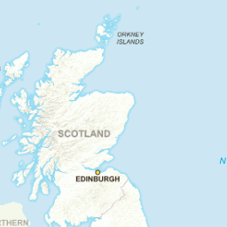
OS GB Overview (OSGBOverview)
Overview mapping for Great Britain
OS GB Overview Faded (OSGBOverviewFaded)
Overview mapping for Great Britain
OS GB Overview Greyscale (OSGBOverviewGrey)
Overview mapping for Great Britain
OS GB Overview Plus (OSGBOverviewPlus)
Overview mapping for Great Britain
OS GB Overview Plus Faded (OSGBOverviewPlusFaded)
Overview mapping for Great Britain
OS GB Overview Plus Greyscale (OSGBOverviewPlusGrey)
Overview mapping for Great Britain
OS MiniScale (OSMiniScaleMapping)
1:1 Million scale mapping for Great Britain
OS MiniScale Faded (OSMiniScaleMappingFaded)
1:1 Million scale mapping for Great Britain
OS MiniScale Greyscale (OSMiniScaleMappingGrey)
1:1 Million scale mapping for Great Britain
1:250,000 OS Mapping (OneTo250KMapping)
1:250,000 scale mapping for Great Britain
1:250,000 OS Mapping Faded (OneTo250KMappingFaded)
1:250,000 scale mapping for Great Britain
1:250,000 OS Mapping Greyscale (OneTo250KMappingGrey)
1:250,000 scale mapping for Great Britain
OS VectorMap District (OSVectorMapDistrict)
OS VectorMap District for Great Britain, greyscale
OS VectorMap District Faded (OSVectorMapDistrictFaded)
OS VectorMap District for Great Britain
OS VectorMap District Greyscale (OSVectorMapDistrictGrey)
OS VectorMap District for Great Britain
OS VectorMap District Vector (OSVectorMapDistrictVec)
OS VectorMap District for Great Britain (converted from vector source)
OS StreetView (OSStreetview)
Street level mapping for Great Britain
OS StreetView Faded (OSStreetviewFaded)
Street level mapping for Great Britain
OS StreetView Greyscale (OSStreetViewGrey)
Street level mapping for Great Britain
Multi scale OS Open data (composite_opencomp)
Multi level OS mapping data
There are currently no notifications for the service, click the feed icon to subscribe.