[unknown data provider] |
|
NOAA Charts

| Service health Now: |
|---|
- Interface
- Web Service, OGC Web Map Service 1.3.0
- Keywords
- Fees
- unknown
- Access constraints
- unknown
- Supported languages
- No INSPIRE Extended Capabilities (including service language support) given. See INSPIRE Technical Guidance - View Services for more information.
- Data provider
-
unknown (unverified)
Contact information:
- Service metadata
- No INSPIRE Extended Capabilities (including service metadata) given. See INSPIRE Technical Guidance - View Services for more information.
Ads by Google
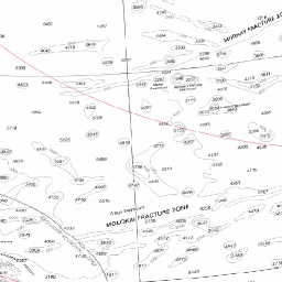
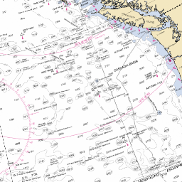
This service provides a set of NOAA Charts for Alaskan waters.
Available map layers (26)
NOAA Charts (NOAA_Charts)
This service provides a set of NOAA Charts for Alaskan waters.
Charts (Charts)
Charts
NOAA_Charts_1:1000000000 (noaa_chart_1000)
This layer is composed of scanned digital raster graphic (DRG) maps at 1:250,000 scale.
NOAA_Charts_1:4850000 (noaa_chart_485)
This layer is composed of scanned digital raster graphic (DRG) maps at 1:250,000 scale.
NOAA_Charts_1:3500000 (noaa_chart_350)
This layer is composed of scanned digital raster graphic (DRG) maps at 1:250,000 scale.
NOAA_Charts_1:2100000 (noaa_chart_210)
This layer is composed of scanned digital raster graphic (DRG) maps at 1:250,000 scale.
NOAA_Charts_1:1550000 (noaa_chart_155)
This layer is composed of scanned digital raster graphic (DRG) maps at 1:250,000 scale.
NOAA_Charts_1:1500000 (noaa_chart_150)
This layer is composed of scanned digital raster graphic (DRG) maps at 1:250,000 scale.
NOAA_Charts_1:1400000 (noaa_chart_140)
This layer is composed of scanned digital raster graphic (DRG) maps at 1:250,000 scale.
NOAA_Charts_1:1200000 (noaa_chart_120)
This layer is composed of scanned digital raster graphic (DRG) maps at 1:250,000 scale.
NOAA_Charts_1:1100000 (noaa_chart_110)
This layer is composed of scanned digital raster graphic (DRG) maps at 1:250,000 scale.
NOAA_Charts_1:1000000 (noaa_chart_100)
This layer is composed of scanned digital raster graphic (DRG) maps at 1:250,000 scale.
NOAA_Charts_1:950000 (noaa_chart_95)
This layer is composed of scanned digital raster graphic (DRG) maps at 1:250,000 scale.
NOAA_Charts_1:850000 (noaa_chart_85)
This layer is composed of scanned digital raster graphic (DRG) maps at 1:250,000 scale.
NOAA_Charts_1:800000 (noaa_chart_80)
This layer is composed of scanned digital raster graphic (DRG) maps at 1:250,000 scale.
NOAA_Charts_1:700000 (noaa_chart_70)
This layer is composed of scanned digital raster graphic (DRG) maps at 1:250,000 scale.
NOAA_Charts_1:500000 (noaa_chart_50)
This layer is composed of scanned digital raster graphic (DRG) maps at 1:250,000 scale.
NOAA_Charts_1:400000 (noaa_chart_40)
This layer is composed of scanned digital raster graphic (DRG) maps at 1:250,000 scale.
NOAA_Charts_1:350000 (noaa_chart_35)
This layer is composed of scanned digital raster graphic (DRG) maps at 1:250,000 scale.
NOAA_Charts_1:300000 (noaa_chart_30)
This layer is composed of scanned digital raster graphic (DRG) maps at 1:250,000 scale.
NOAA_Charts_1:200000 (noaa_chart_20)
This layer is composed of scanned digital raster graphic (DRG) maps at 1:250,000 scale.
NOAA_Charts_1:150000 (noaa_chart_15)
This layer is composed of scanned digital raster graphic (DRG) maps at 1:250,000 scale.
NOAA_Charts_1:100000 (noaa_chart_10)
This layer is composed of scanned digital raster graphic (DRG) maps at 1:250,000 scale.
NOAA_Charts_1:50000 (noaa_chart_5)
This layer is composed of scanned digital raster graphic (DRG) maps at 1:250,000 scale.
NOAA_Charts_1:10000 (noaa_chart_1)
This layer is composed of scanned digital raster graphic (DRG) maps at 1:250,000 scale.
NOAA_Charts_1:5000 (noaa_chart_0)
This layer is composed of scanned digital raster graphic (DRG) maps at 1:250,000 scale.
There are currently no notifications for the service, click the feed icon to subscribe.