IGME (Geological Survey of Spain) |
|
| Service health Now: |
|---|
- Interface
- Web Service, OGC Web Map Service 1.3.0
- Keywords
- IGME, oneGeology, Geology, WMS
- Fees
- Gratuito
- Access constraints
- No está permitido implementar un servicio de valor añadido no gratuito sin establecer contacto con el IGME
- Supported languages
- spa
- Data provider
-
IGME (Geological Survey of Spain) (unverified)
Contact information:
Área de Sistemas de Información Geocientífica
IGME (Geological Survey of Spain)
Postal:
Rios Rosas 23, 28003 Madrid, SpainEmail:
- Service metadata
Ads by Google
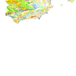
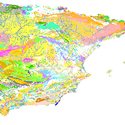
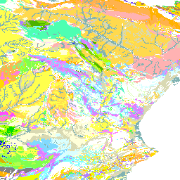
The 1:1M Geological Map of Spain covers the Spanish part of the Iberian Peninsula, the Balearic Islands, the Canary Islands, and Ceuta and Melilla (African territories). The Geologic Units are represented in three different layers: Bedrock and Superficial Units, Lithology Units and Geologic Age. An additional layer of faults is also available. For the Geological Age the International Stratigraphic Chart (2006) have been used. The Chronostratigraphic Units included are Erathem and System.
Available map layers (4)
ESP IGME 1:1M GeologicUnits (0)
ESP IGME 1:1M GeologicUnits
ESP IGME 1:1M Faults (1)
ESP IGME 1:1M Faults
ESP IGME 1:1M Lithology (2)
ESP IGME 1:1M Lithology
ESP IGME 1:1M Age (3)
ESP IGME 1:1M Age
There are currently no notifications for the service, click the feed icon to subscribe.