Agriculture and Agri-Food Canada |
|
Spatial Density of Canola (2009-2015)
http://www.agr.gc.ca/atlas/services/mapservices/aafc_crop_spatial_density_canola/MapServer/WmsServer
| Service health Now: |
|---|
- Interface
- Web Service, OGC Web Map Service 1.3.0
- Keywords
- Crops, Agricultural Statistics
- Fees
- unknown
- Access constraints
- © Government of Canada (2016). Data are subject to the Government of Canada Open Data Licence Agreement: http://open.canada.ca/en/open-government-licence-canada. The terms of this Agreement govern your use and reproduction of the data instead of the copyright reproduction statements found in Important Notices on the Agriculture and Agri-Food Canada website.
- Supported languages
- No INSPIRE Extended Capabilities (including service language support) given. See INSPIRE Technical Guidance - View Services for more information.
- Data provider
-
Agriculture and Agri-Food Canada (unverified)
Contact information:
Agri-Geomatics
Agriculture and Agri-Food Canada
Canada
Email:
- Service metadata
- No INSPIRE Extended Capabilities (including service metadata) given. See INSPIRE Technical Guidance - View Services for more information.
Ads by Google
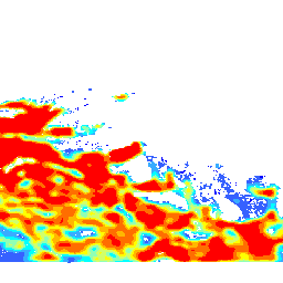
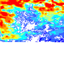
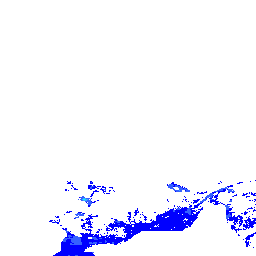
This data shows spatial density of Canola cultivation in Canada. Regions with higher calculated spatial densities represent agricultural regions of Canada in which Canola is more expected. Results are provided as rasters with numerical values for each pixel indicating the spatial density calculated for that location. Higher spatial density values represent higher likelihood to have Canola based on analysis of the 2009 to 2015 AAFC annual crop inventory data. For more information, visit: http://open.canada.ca/data/en/dataset/a1da661a-55b6-4ef5-936a-fb1b6f4fa486
Available map layers (1)
Spatial Density of Canola in Canada (0)
fdf82539-5a74-440b-86ef-a16b7801c706
There are currently no notifications for the service, click the feed icon to subscribe.