Bundesanstalt für Geowissenschaften un… |
|
BGR Grundwasser: WHYMAP GWR
| Service health Now: |
|---|
- Interface
- Web Service, OGC Web Map Service 1.3.0
- Keywords
- Grundwasservorkommen, Geologie, Groundwater, Grundwasserneubildung, Weltweit, Hydrogeologie, Grundwasser, Aquifer, Groundwater recharge, Groundwater abstraction, World-wide, Hydrogeology, Groundwater resources, Grundwasserentnahme, Geology
- Fees
- NONE
- Access constraints
- Allgemeine Geschäftsbedingungen, s.: https://www.bgr.bund.de/AGB - General terms and conditions, s. https://www.bgr.bund.de/AGB_en; Die bereitgestellten Informationen sind bei Weiterverwendung wie folgt zu zitieren: Datenquelle: WHYMAP, (C) BGR Hannover & UNESCO Paris
- Supported languages
- eng
- Data provider
-
Bundesanstalt für Geowissenschaften und Rohstoffe (BGR) (unverified)
Contact information:
BGR Geodatendienste
Bundesanstalt für Geowissenschaften und Rohstoffe (BGR)
postal:
Stilleweg 2, 30655 Hannover, DEEmail:
Phone: +49 511 643 - 3433
- Service metadata
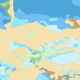
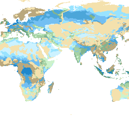
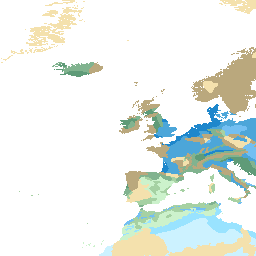
The World-wide Hydrogeological Mapping and Assessment Programme (WHYMAP) provides data and information about the earth´s major groundwater resources. The Groundwater Resources Map shows various characteristic groundwater environments in their areal extent and classified by their aquifer productivity and recharge potential. Additional groundwater related features such as wetlands and areas of low rainfall are included in the dataset.
Available map layers (11)
Groundwater resources and recharge (mm/a) (0)
The World-wide Hydrogeological Mapping and Assessment Programme (WHYMAP) provides data and information about the Earth´s major groundwater resources. The programme compiles hydrogeological information from regional, national and global sources, and visualizes the groundwater data as printed maps, web map application and web map service. These products provide information on quantity, quality and vulnerability of the groundwater resources on Earth and help communicating groundwater related issues to water experts, decision makers and the general public.
Area of saline groundwater (> 5 g/l TDS) (1)
Area of low rainfall (< 200 mm/a) (2)
Boundary of continuous permafrost (3)
Continuous ice sheet (5)
River (6)
Lake (7)
Selected city, partly dependent on groundwater (8)
Selected wetland, mostly groundwater related (9)
Groundwater abstraction & groundwater mining (10)
Natural groundwater discharge area in arid regions (11)