Government of Canada; Natural Resource… |
|
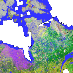
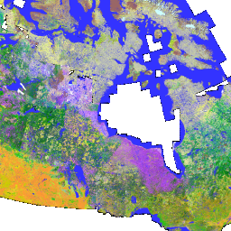
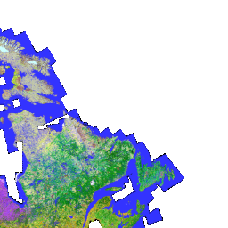
Land Cover circa 2000
| Service health Now: |
|---|
- Interface
- Web Service, OGC Web Map Service 1.3.0
- Keywords
- Fees
- None
- Access constraints
- http://open.canada.ca/en/open-government-licence-canada
- Supported languages
- No INSPIRE Extended Capabilities (including service language support) given. See INSPIRE Technical Guidance - View Services for more information.
- Data provider
-
Government of Canada; Natural Resources Canada; Earth Sciences Sector; Canada Centre for Mapping and Earth Observation (CCMEO) (unverified)
Contact information:
Government of Canada; Natural Resources Canada; Earth Sciences Sector; Canada Centre for Mapping and Earth Observation (CCMEO)
Canada
Email:
Phone: 1 (819) 564-5600 / 1 (800) 661-2638
- Service metadata
- No INSPIRE Extended Capabilities (including service metadata) given. See INSPIRE Technical Guidance - View Services for more information.
Ads by Google
Land Cover information is the result of vectorization of raster thematic data originating from classified Landsat 5 and Landsat 7 ortho-images, for agricultural and forest areas of Canada, and for Northern Territories. The forest cover was produced by the Earth Observation for Sustainable Development (EOSD) project, an initiative of the Canadian Forest Service (CFS) with the collaboration of the Canadian Space Agency (CSA) and in partnership with the provincial and territorial governments. The agricultural coverage is produced by the National Land and Water Information Service (NLWIS) of Agriculture and Agri-Food Canada (AAFC). Northern Territories land cover was realized by the Canadian Centre of Remote Sensing (CCRS). Land Cover data are classified according to a harmonized legend build from the partners legends.
Available map layers (12)
Land Cover circa 2000 (landcover_csc2000_2)
Land Cover information is the result of vectorization of raster thematic data originating from classified Landsat 5 and Landsat 7 ortho-images, for agricultural and forest areas of Canada, and for Northern Territories. The forest cover was produced by the Earth Observation for Sustainable Development (EOSD) project, an initiative of the Canadian Forest Service (CFS) with the collaboration of the Canadian Space Agency (CSA) and in partnership with the provincial and territorial governments. The agricultural coverage is produced by the National Land and Water Information Service (NLWIS) of Agriculture and Agri-Food Canada (AAFC). Northern Territories land cover was realized by the Canadian Centre of Remote Sensing (CCRS). Land Cover data are classified according to a harmonized legend build from the partners legends.
Land Cover - circa 2000 (landcover_csc2000_2)
Legend
Legend (landcover_csc2000_2.legend)
Legend
Land Cover, Circa 2000 (landcover:csc2000)
Land Cover information is the result of vectorization of raster thematic data originating from classified Landsat 5 and Landsat 7 ortho-images, for agricultural and forest areas of Canada, and for Northern Territories. The forest cover was produced by the Earth Observation for Sustainable Development (EOSD) project, an initiative of the Canadian Forest Service (CFS) with the collaboration of the Canadian Space Agency (CSA) and in partnership with the provincial and territorial governments. The agricultural coverage is produced by the National Land and Water Information Service (NLWIS) of Agriculture and Agri-Food Canada (AAFC). Northern Territories land cover was realized by the Canadian Centre of Remote Sensing (CCRS). Land Cover data are classified according to a harmonized legend build from the partners legends.
CSC2000 level 0 overview (landcover:csc2000:zoom0)
CSC2000 overview between 1:15 million and 1:45 million scales.
CSC2000 level 0 overview (landcover:csc2000:zoom1)
CSC2000 overview for 1:5 million and 1:15 million scales.
CSC2000 level 1 overview (landcover:csc2000:overview1)
CSC2000 overview for 1:2 million and 1:5 million scales.
CSC2000 level 1 overview (landcover:csc2000:overview2)
CSC2000 overview for 1:1 million and 1:2 million scales.
CSC2000 level 1 overview (landcover:csc2000:overview3)
CSC2000 overview for 1:750,000 and 1:1 million scales.
CSC2000 level 4 overview (landcover:csc2000:overview4)
CSC2000 overview for 1:400,000 and 1:750,000 scales.
CSC2000 level 5 overview (landcover:csc2000:overview5)
CSC2000 overview for 1:200,000 and 1:400,000 scales.
Land Cover circa 2000 (landcover:csc2000)
Land Cover circa 2000
There are currently no notifications for the service, click the feed icon to subscribe.