Earth Observation Center (EOC), DLR |
|
EOC Land Map Service
| Service health Now: |
|---|
- Interface
- Web Service, OGC Web Map Service 1.1.1
- Keywords
- DLR, EOC, CORINE, CORINE2000, CORINE2006, Germany, Global Snowpack
- Fees
- NONE
- Access constraints
- NONE
- Data provider
-
Earth Observation Center (EOC), DLR (unverified)
Contact information:
Geoservice Manager
Earth Observation Center (EOC), DLR
Postal:
Münchnerstraße 20, 82234 Weßling, GermanyEmail:
This Web Mapping Service provides access to geospatial map products within the Earth Observation Center (EOC). WMS access to CORINE 2000, CORINE 2006 land cover data sets and Global Snowpack products is provided.
Available map layers (19)
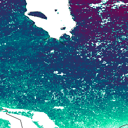
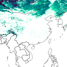
GLOBAL_SNOWPACK_SCD_LATLON_LAYER_GROUP (GLOBAL_SNOWPACK_SCD_LATLON_LAYER_GROUP)
Layer-Group type layer: GLOBAL_SNOWPACK_SCD_LATLON_LAYER_GROUP
GLOBAL_SNOWPACK_SIN_SCD_LAYER_GROUP (GLOBAL_SNOWPACK_SIN_SCD_LAYER_GROUP)
Layer-Group type layer: GLOBAL_SNOWPACK_SIN_SCD_LAYER_GROUP
GLOBAL_SNOWPACK_LATLON_SCDES_LAYER_GROUP (GLOBAL_SNOWPACK_LATLON_SCDES_LAYER_GROUP)
Layer-Group type layer: GLOBAL_SNOWPACK_LATLON_SCDES_LAYER_GROUP
GLOBAL_SNOWPACK_SIN_SCDES_LAYER_GROUP (GLOBAL_SNOWPACK_SIN_SCDES_LAYER_GROUP)
Layer-Group type layer: GLOBAL_SNOWPACK_SIN_SCDES_LAYER_GROUP
GLOBAL_SNOWPACK_LATLON_SCDLS_LAYER_GROUP (GLOBAL_SNOWPACK_LATLON_SCDLS_LAYER_GROUP)
Layer-Group type layer: GLOBAL_SNOWPACK_LATLON_SCDLS_LAYER_GROUP
GLOBAL_SNOWPACK_SIN_SCDLS_LAYER_GROUP (GLOBAL_SNOWPACK_SIN_SCDLS_LAYER_GROUP)
Layer-Group type layer: GLOBAL_SNOWPACK_SIN_SCDLS_LAYER_GROUP
clc2000_1k_u32 (CORINE_LAND_COVER_2000_1000x1000)
Corine Land Cover 2000 Year: 2000 Horizontal Resolution: 1000 x 1000 m Projection: UTM32
clc2000_100u32 (CORINE_LAND_COVER_2000_100x100)
Corine Land Cover 2000 Year: 2000 Horizontal Resolution: 100 x 100 m Projection: UTM32
clc2000_250u32 (CORINE_LAND_COVER_2000_250x250)
Corine Land Cover 2000 Year: 2000 Horizontal Resolution: 250 x 250 m Projection: UTM32
clc06_de_ut32 (CORINE_LAND_COVER_2006_100x100)
Corine Land Cover 2006 Year: 2006 Horizontal Resolution: 100 x 100 m Projection: UTM32
Global Snowpack LatLon Snow Cover Duration Early Season Layer (GLOBAL_SNOWPACK_SCDES_LATLON)
Global Snowpack Sinusoidal Snow Cover Duration Early Season Layer (GLOBAL_SNOWPACK_SCDES_SIN)
Global Snowpack LatLon Snow Cover Duration Late Season Layer (GLOBAL_SNOWPACK_SCDLS_LATLON)
Global Snowpack Sinusoidal Snow Cover Duration Late Season Layer (GLOBAL_SNOWPACK_SCDLS_SIN)
Global Snowpack LatLon Snow Cover Duration Layer (GLOBAL_SNOWPACK_SCD_LATLON)
Global Snowpack Sinusoidal Snow Cover Duration Layer (GLOBAL_SNOWPACK_SCD_SIN)
GUF28_DLR_v1_Mosaic (for scientific use only) (GUF04_DLR_v1_Mosaic)
This layer represents the Global Urban Footprint® (GUF®) in it's 0.4 arcsecond / ~ 12m resolution version optimized for web service access. The datasets shows two land cover categories: Built-up areas (vertical structures only) are represented with value 255 and non-build-up surfaces with value 0. Areas of no coverage by the satellites are coded as value 128. For small-scale visualisation, reduced resolution overviews have been generated with an interpolation algorithm, that computes the average value of all contribution pixels. See the link to the metadata for more information. GUF® and Global Urban Footprint® are protected as trademarks. A non-exclusive, spatially and temporally unlimited, non-transferable, non-sublicensable right to use GUF is granted free of charge for a) scientific purposes on the high resolution version of GUF® (0.4 arcseconds), b) non-commercial purposes on the low resolution version of the GUF® (2.8 arcseconds). This license does not grant any commercial use of GUF® or products generated or derived by GUF®.
GUF28_DLR_v1_Mosaic (for non-commercial use only) (GUF28_DLR_v1_Mosaic)
This layer represents the Global Urban Footprint® (GUF®) in it's 2.8 arcsecond / ~ 84m resolution version optimized for web service access. The datasets shows two land cover categories: Built-up areas (vertical structures only) are represented with value 255 and non-build-up surfaces with value 0. Areas of no coverage by the satellites are coded as value 128. For small-scale visualisation, reduced resolution overviews have been generated with an interpolation algorithm, that computes the average value of all contribution pixels. See the link to the metadata for more information. GUF® and Global Urban Footprint® are protected as trademarks. A non-exclusive, spatially and temporally unlimited, non-transferable, non-sublicensable right to use GUF is granted free of charge for a) scientific purposes on the high resolution version of GUF® (0.4 arcseconds), b) non-commercial purposes on the low resolution version of the GUF® (2.8 arcseconds). This license does not grant any commercial use of GUF® or products generated or derived by GUF®.
ne_countries (ne_countries)
Layer-Group type layer: ne_countries