National Geographic Institute |
|
Inspire DTM 20m WMS
| Service health Now: |
|---|
- Interface
- Web Service, OGC Web Map Service 1.1.1
- Keywords
- Fees
- none
- Access constraints
- none
- Data provider
-
National Geographic Institute (unverified)
Contact information:
Commercial Department
National Geographic Institute
postal:
Abdij ter Kameren 13, 1000 Brussels, BelgiumEmail:
Phone: 0032 (0)2 629 82 82
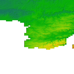
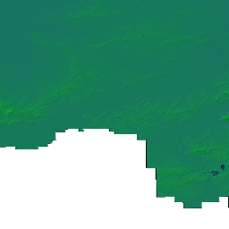
The DTM is a homogeneous and regular point grid indicating the elevation of the ground level in order to make a model of its surface. The
Available map layers (1)
Elevation Grid Coverage (Elevation)
The Elevation of a terrain surface, described the Earth's morphology