GNS Science |
|
GeoServer Web Map Service
| Service health Now: |
|---|
- Interface
- Web Service, OGC Web Map Service 1.3.0
- Keywords
- WFS, WMS, GEOSERVER
- Fees
- NONE
- Access constraints
- NONE
- Supported languages
- No INSPIRE Extended Capabilities (including service language support) given. See INSPIRE Technical Guidance - View Services for more information.
- Data provider
-
GNS Science (unverified)
Contact information:
Soren Haubrock
GNS Science
PO Box 30-368, 5040 Lower Hutt, New Zealand
Email:
Phone: +64 4 570 4630
- Service metadata
- No INSPIRE Extended Capabilities (including service metadata) given. See INSPIRE Technical Guidance - View Services for more information.
Ads by Google
A compliant implementation of WMS plus most of the SLD extension (dynamic styling). Can also generate PDF, SVG, KML, GeoRSS
Available map layers (194)
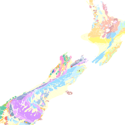
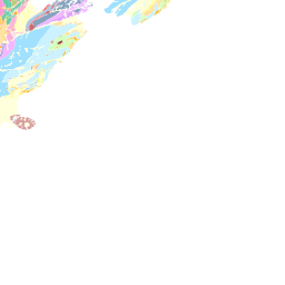
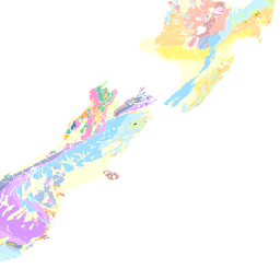
1mgeology (gns:1mgeology)
seismic (gns:2D_SEIS_LINES)
FR.FRED_SITE_VIEW (gns:FR.FRED_SITE_VIEW)
FRED_SITE_VIEW (gns:FRED_SITE_VIEW)
GIS.BLUE_MARBLE (gns:GIS.BLUE_MARBLE)
GIS.NZ_DTM_SHADE (gns:GIS.NZ_DTM_SHADE)
GIS.NZ_ORTHOPHOTO (gns:GIS.NZ_ORTHOPHOTO)
GIS.REGIONAL_COUNCIL_CLIP_SIMP (gns:GIS.REGIONAL_COUNCIL_CLIP_SIMP)
GIS.TERRITORIAL_COUNCIL (gns:GIS.TERRITORIAL_COUNCIL)
MARINE.DSDP_ODP_VIEW (gns:MARINE.DSDP_ODP_VIEW)
Ocean Drilling Program and Deep Sea Drilling Program locations URL:
MASTERFILE_AREAS (gns:MASTERFILE_AREAS)
MASTERFILE_AREAS_SHP (gns:MASTERFILE_AREAS_SHP)
MINERAL.COALFIELDS (gns:MINERAL.COALFIELDS)
MINERAL.COAL_DRILLHOLE (gns:MINERAL.COAL_DRILLHOLE)
MINERAL.GEOTHERMAL_FIELDS (gns:MINERAL.GEOTHERMAL_FIELDS)
MINERAL.GERM_FEATURE_VIEW (gns:MINERAL.GERM_FEATURE_VIEW)
MINERAL.IRONSAND_DEPOSITS (gns:MINERAL.IRONSAND_DEPOSITS)
MINERAL.MINERAL_DRILLHOLE (gns:MINERAL.MINERAL_DRILLHOLE)
MINERAL.PERMIT (gns:MINERAL.PERMIT)
NZL-Urban_Auckland_geological_units (gns:NZL-Urban_Auckland_geological_units)
NZL-Urban Blenheim geological units (gns:NZL-Urban_Blenheim_geological_units)
NZL-Urban Christchurch geological units (gns:NZL-Urban_Christchurch_geological_units)
NZL-Urban Dunedin geological units (gns:NZL-Urban_Dunedin_geological_units)
NZL-Urban Gisborne geological units (gns:NZL-Urban_Gisborne_geological_units)
NZL-Urban Invercargill geological units (gns:NZL-Urban_Invercargill_geological_units)
NZL-Urban Napier Hastings geological units (gns:NZL-Urban_Napier_Hastings_geological_units)
NZL-Urban Nelson geological units (gns:NZL-Urban_Nelson_geological_units)
NZL-Urban Rotorua geological units (gns:NZL-Urban_Rotorua_geological_units)
NZL-Urban Wanganui geological units (gns:NZL-Urban_Wanganui_geological_units)
NZL-Urban Wellington geological units (gns:NZL-Urban_Wellington_geological_units)
NZL-Urban Whangarei geological units (gns:NZL-Urban_Whangarei_geological_units)
PET.PET_SITE_VIEW (gns:PET.PET_SITE_VIEW)
PETROLEUM.DOC_PUBLICCONSERVATIONLAND (gns:PETROLEUM.DOC_PUBLICCONSERVATIONLAND)
PETROLEUM.GRAVITY_STATION_VIEW (gns:PETROLEUM.GRAVITY_STATION_VIEW)
PETROLEUM.GRAVITY_SURVEY_VIEW (gns:PETROLEUM.GRAVITY_SURVEY_VIEW)
PETROLEUM.IWI_BOUNDARIES (gns:PETROLEUM.IWI_BOUNDARIES)
PETROLEUM.LICENSE (gns:PETROLEUM.LICENSE)
New Zealand Petroleum & Minerals supplied license data (NZTM). Petroleum exploration license and permit extents. regulatory framework May 2012
PETROLEUM.NZ_2D_SEIS_LINES (gns:PETROLEUM.NZ_2D_SEIS_LINES)
PETROLEUM.NZ_2D_SEIS_SURVEYS (gns:PETROLEUM.NZ_2D_SEIS_SURVEYS)
Keywords Theme: 2D seismic surveys, Original navigation Place: New Zealand, Extended Continental Shelf Stratum: Open File data, Crown Minerals Description Abstract NZ open file petroleum exploration 2D seismic data Purpose Spatial representation of 2D seismic survey exploration effort and associated acquisition technology metadata Supplementary Information generated from original UKOOA and P1/90 header and navigation data _________________ Status of the data In work Data update frequency: Irregular Time period for which the data is relevant Date and time: 2011 Description: 17/2/2011 Publication Information Who created the data: GNS Science Date and time: Feb 2011
PETROLEUM.NZ_3D_SEIS_SURVEYS (gns:PETROLEUM.NZ_3D_SEIS_SURVEYS)
Keywords Theme: 3D seismic surveys Place: New Zealand, Extended Continental Shelf Stratum: Open File data, Crown Minerals Temporal: current Description Abstract NZ open file petroleum exploration 3D seismic data Purpose Spatial representation of 3D seismic survey exploration effort and associated acquisition technology metadata Supplementary Information generated from PR's _________________ Status of the data In work Data update frequency: Irregular Time period for which the data is relevant Date and time: 2011 Description: 17/2/2011 Publication Information Who created the data: GNS Science Date and time: Feb 2011 _________________ Data storage and access information File name: PETROLEUM.NZ_3D_SEIS_SURVEYS Type of data: vector digital data Location of the data: Server=SDE.gns.cri.nz; Service=5151; Database=petroleum; User=petroleum; Version=SDE.DEFAULT Data processing environment: Microsoft Windows XP Version 5.1 (Build 2600) Service Pack 3; ESRI ArcCatalog 9.3.0.1770 Constraints on accessing and using the data Access constraints: GNS DUL Use constraints: GNS acknowledgement Details about this document Contents last updated: 20110328 at time 10445700
PETROLEUM.NZ_BASIN_SOURCE (gns:PETROLEUM.NZ_BASIN_SOURCE)
PETROLEUM.NZ_BASIN_TRANSECTS (gns:PETROLEUM.NZ_BASIN_TRANSECTS)
Selected interpreted seismic cross sections displaying the key sedimentary features of the basin
PETROLEUM.NZ_BLOCKS_OFFER_2013 (gns:PETROLEUM.NZ_BLOCKS_OFFER_2013)
NZP&M 2013 Blocks Offer. Shapefile updated May 2013. Block Offer 2013 includes 189,000 square kilometres of offshore and over 1,500 square kilometres of onshore area. The following areas will be open for bidding on 24 May: three defined onshore blocks in Taranaki two defined onshore blocks on the East Coast of the North Island three offshore release areas in the Reinga-Northland Basins, Taranaki Basin and Great South-Canterbury Basins
PETROLEUM.NZ_DSDP_ODP_IODP_BOREHOLES (gns:PETROLEUM.NZ_DSDP_ODP_IODP_BOREHOLES)
Current distribution (September 2012) of DSDP, ODP and IODP borehole sites and related metadata including links to datasets. Shapefile created by GNS Science from kml file sourced at http://www.iodp.org/borehole-map.
PETROLEUM.NZ_ECS_LINE (gns:PETROLEUM.NZ_ECS_LINE)
New Zealand extended continental shelf. UNCLOS defined limits Line
PETROLEUM.NZ_EEZ_LINE (gns:PETROLEUM.NZ_EEZ_LINE)
New Zealand Exclusive Economic Zone
PETROLEUM.NZ_FOLIO1_TRANS (gns:PETROLEUM.NZ_FOLIO1_TRANS)
Displays transects lines through NZ sediemtary basins along which chronstratigraphic cross section panels have been assembled.
PETROLEUM.NZ_LICENSE (gns:PETROLEUM.NZ_LICENSE)
Current petroleum exploration license and permit extents. December 2012.
PETROLEUM.NZ_MEAS_SECTIONS (gns:PETROLEUM.NZ_MEAS_SECTIONS)
PETROLEUM.NZ_OIL_GAS_FIELDS (gns:PETROLEUM.NZ_OIL_GAS_FIELDS)
New Zealand Oil and Gas producing fields
PETROLEUM.NZ_PETROL_INFRASTRUCT (gns:PETROLEUM.NZ_PETROL_INFRASTRUCT)
PETROLEUM.NZ_PETROL_PIPELINES (gns:PETROLEUM.NZ_PETROL_PIPELINES)
PETROLEUM.NZ_PR_POLYGONS (gns:PETROLEUM.NZ_PR_POLYGONS)
Spatial coverages of open file PR reports defined by the report topic (eg permit, seismic survey, well completion report etc). Updated Nov 2012
PETROLEUM.NZ_PR_REGIONS (gns:PETROLEUM.NZ_PR_REGIONS)
Spatial coverages of open file PR reports defined by the report topic (eg permit, seismic survey, well completion report etc)
PETROLEUM.NZ_QMAP (gns:PETROLEUM.NZ_QMAP)
Coverage of QMAP projected in WGS 84, with publication date and link fields
PETROLEUM.NZ_REG_BATHY (gns:PETROLEUM.NZ_REG_BATHY)
PETROLEUM.NZ_RESEARCH_SEIS (gns:PETROLEUM.NZ_RESEARCH_SEIS)
Single and multichannel research seismic in the SW Pacific region
PETROLEUM.NZ_SEDIMENTARY_BASINS (gns:PETROLEUM.NZ_SEDIMENTARY_BASINS)
Keywords Theme: Sedimentary Basins, Potential petroleum basins Place: New Zealand extend continental shelf, South West Pacific Stratum: Sedimentary sequences Temporal: Mesozoic-Cenozoic Description Abstract Compilation of known sedimentary basin extents as of October 2010 Purpose Representation of current knowledge of NZ regional sedimentary basin extents Supplementary Information Initially digistised from graphic provided in the Crown Minerals "Blue Book" Subsequently modified by M Isaac and edited in Arc by C Jones for CM PEGI 6 -OPA project March 2011 _________________ Status of the data In work Data update frequency: Irregular Time period for which the data is relevant Date and time: REQUIRED: The year (and optionally month, or month and day) for which the data set corresponds to the ground. Description: publication date Publication Information Who created the data: Digitised by A Giffin, GNS Science, edited and loaded onto SDE Nov 2010 by C Jones. Further edits March 2011 Date and time: March 2011 _________________ Data storage and access information File name: PETROLEUM.NZ_SEDIMENTARY_BASINS Type of data: vector digital data Location of the data: Server=SDE.gns.cri.nz; Service=5151; Database=petroleum; User=petroleum; Version=SDE.DEFAULT Data processing environment: Microsoft Windows XP Version 5.1 (Build 2600) Service Pack 3; ESRI ArcCatalog 9.3.0.1770 Accessing the data Data transfer size: 1.047 MB Constraints on accessing and using the data Access constraints: Not to be duplicated or passed on to third parties Use constraints: GNS Science Data use license
PETROLEUM.NZ_SEDI_BASIN_OUTLINES (gns:PETROLEUM.NZ_SEDI_BASIN_OUTLINES)
Digitised by A Giffin, GNS Science, edited and loaded onto SDE Nov 2010 by C Jones Compilation of known sedimentary basin extents as of October 2010 Representation of current knowledge of NZ regional sedimentary basin extents digistised from graphic provided in the Crown Minerals "Blue Book" New Zealand extend continental shelf South West Pacific Sedimentary sequences Mesozoic-Cenozoic
PETROLEUM.NZ_SINGLEBEAM (gns:PETROLEUM.NZ_SINGLEBEAM)
PETROLEUM.NZ_SWATH_AREA (gns:PETROLEUM.NZ_SWATH_AREA)
Keywords Theme: SW Pacific swath coverages, GNS Science, LINZ and NIWA, Swath bathymetry Place: New Zealand, South West Pacific Stratum: Sea floor imagery, bathymetry Temporal: Modern Description Abstract GNS Science LINZ and NIWA Swath polygons coverages combined for SW Pacific region Purpose Representative data for PEGI EFBS porject _________________ Status of the data In work Data update frequency: Irregular Time period for which the data is relevant Date and time: 11/4/2011 Description: publication date Publication Information Who created the data: GNS Science LINZ and NIWA Date and time: Feb 2012
PETROLEUM.NZ_SWATH_GNS (gns:PETROLEUM.NZ_SWATH_GNS)
Keywords Theme: GNS swath coverages Place: New Zealand Stratum: Sea floor imagery Temporal: Modern Description Abstract GNS Swath polygons coverage Purpose Representative data for PEGI EFBS porject _________________ Status of the data In work Data update frequency: Irregular Time period for which the data is relevant Date and time: 11/4/2011 Description: publication date
PETROLEUM.NZ_TERRANES_5M (gns:PETROLEUM.NZ_TERRANES_5M)
New Zealand pre-Cenozoic basement rocks subdivided into tectonostratigraphic terranes and batholiths
PETROLEUM.NZ_TERRITORIAL_12_MILE_WATERS (gns:PETROLEUM.NZ_TERRITORIAL_12_MILE_WATERS)
PETROLEUM.PEGI_SITE_VIEW (gns:PETROLEUM.PEGI_SITE_VIEW)
PEGI product site locations and associated PEGI outputs
NZ Petroleum Wells (gns:PETROLEUM.PETROLEUM_WELL_VIEW)
New Zealand Petroleum Wells Keywords Theme: Petroleum exploration wells Place: New Zealand, Onshore, Offshore Stratum: Sedimentary basins Temporal: 1866-2006 Description Abstract GNS Petroleum Well header reference data Purpose Master spatial dataset of NZ petroleum wells Supplementary Information Updated and maintained by the Petroleum Geosciences data administrator ________________ Status of the data In work Data update frequency: Irregular Time period for which the data is relevant Date and time: Oct 2011 Description: ground condition Publication Information Who created the data: GNS Science Date and time: Oct 2011
PSV (gns:PSV)
QMAP_2012_SimpleMineralMetamorphismPoly (gns:QMAP_2012_SimpleMineralMetamorphismPoly)
QMAP_Faults_AKL (gns:QMAP_Faults_AKL)
QMAP_Faults_AOR (gns:QMAP_Faults_AOR)
QMAP_Faults_CCH (gns:QMAP_Faults_CCH)
QMAP_Faults_DUN (gns:QMAP_Faults_DUN)
QMAP_Faults_FLD (gns:QMAP_Faults_FLD)
QMAP_Faults_GRE (gns:QMAP_Faults_GRE)
QMAP_Faults_HAS (gns:QMAP_Faults_HAS)
QMAP_Faults_HAW (gns:QMAP_Faults_HAW)
QMAP_Faults_KAI (gns:QMAP_Faults_KAI)
QMAP_Faults_KAT (gns:QMAP_Faults_KAT)
QMAP_Faults_MUR (gns:QMAP_Faults_MUR)
QMAP_Faults_NEL (gns:QMAP_Faults_NEL)
QMAP_Faults_RAU (gns:QMAP_Faults_RAU)
QMAP_Faults_SI (gns:QMAP_Faults_SI)
QMAP_Faults_TAR (gns:QMAP_Faults_TAR)
QMAP_Faults_WAI (gns:QMAP_Faults_WAI)
QMAP_Faults_WAK (gns:QMAP_Faults_WAK)
QMAP_Faults_WAR (gns:QMAP_Faults_WAR)
QMAP_Faults_WEL (gns:QMAP_Faults_WEL)
QMAP_Faults_WHA (gns:QMAP_Faults_WHA)
QMAP_Faults_WKT (gns:QMAP_Faults_WKT)
QMAP_Faults_inactive_SI (gns:QMAP_Faults_inactive_SI)
QMAP_Folds_AKL (gns:QMAP_Folds_AKL)
QMAP_Folds_AOR (gns:QMAP_Folds_AOR)
QMAP_Folds_CCH (gns:QMAP_Folds_CCH)
QMAP_Folds_DUN (gns:QMAP_Folds_DUN)
QMAP_Folds_FLD (gns:QMAP_Folds_FLD)
QMAP_Folds_GRE (gns:QMAP_Folds_GRE)
QMAP_Folds_HAS (gns:QMAP_Folds_HAS)
QMAP_Folds_HAW (gns:QMAP_Folds_HAW)
QMAP_Folds_KAI (gns:QMAP_Folds_KAI)
QMAP_Folds_KAT (gns:QMAP_Folds_KAT)
QMAP_Folds_MUR (gns:QMAP_Folds_MUR)
QMAP_Folds_NEL (gns:QMAP_Folds_NEL)
QMAP_Folds_RAU (gns:QMAP_Folds_RAU)
QMAP_Folds_TAR (gns:QMAP_Folds_TAR)
QMAP_Folds_WAI (gns:QMAP_Folds_WAI)
QMAP_Folds_WAK (gns:QMAP_Folds_WAK)
QMAP_Folds_WAR (gns:QMAP_Folds_WAR)
QMAP_Folds_WEL (gns:QMAP_Folds_WEL)
QMAP_Folds_WHA (gns:QMAP_Folds_WHA)
QMAP_Folds_WKT (gns:QMAP_Folds_WKT)
QMAP_Geol_U_L_AKL (gns:QMAP_Geol_U_L_AKL)
QMAP_Geol_U_L_AOR (gns:QMAP_Geol_U_L_AOR)
QMAP_Geol_U_L_CCH (gns:QMAP_Geol_U_L_CCH)
QMAP_Geol_U_L_DUN (gns:QMAP_Geol_U_L_DUN)
QMAP_Geol_U_L_FLD (gns:QMAP_Geol_U_L_FLD)
QMAP_Geol_U_L_GRE (gns:QMAP_Geol_U_L_GRE)
QMAP_Geol_U_L_HAS (gns:QMAP_Geol_U_L_HAS)
QMAP_Geol_U_L_HAW (gns:QMAP_Geol_U_L_HAW)
QMAP_Geol_U_L_KAT (gns:QMAP_Geol_U_L_KAT)
QMAP_Geol_U_L_MUR (gns:QMAP_Geol_U_L_MUR)
QMAP_Geol_U_L_RAU (gns:QMAP_Geol_U_L_RAU)
QMAP_Geol_U_L_TAR (gns:QMAP_Geol_U_L_TAR)
QMAP_Geol_U_L_WAI (gns:QMAP_Geol_U_L_WAI)
QMAP_Geol_U_L_WAK (gns:QMAP_Geol_U_L_WAK)
QMAP_Geol_U_L_WAR (gns:QMAP_Geol_U_L_WAR)
QMAP_Geol_U_L_WEL (gns:QMAP_Geol_U_L_WEL)
QMAP_Geol_U_L_WHA (gns:QMAP_Geol_U_L_WHA)
QMAP_Geol_U_L_WKT (gns:QMAP_Geol_U_L_WKT)
QMAP_Geol_U_P_AKL (gns:QMAP_Geol_U_P_AKL)
QMAP_Geol_U_P_AOR (gns:QMAP_Geol_U_P_AOR)
QMAP_Geol_U_P_CC (gns:QMAP_Geol_U_P_CC)
QMAP_Geol_U_P_DUN (gns:QMAP_Geol_U_P_DUN)
QMAP_Geol_U_P_FLD (gns:QMAP_Geol_U_P_FLD)
QMAP_Geol_U_P_GRE (gns:QMAP_Geol_U_P_GRE)
QMAP_Geol_U_P_HAS (gns:QMAP_Geol_U_P_HAS)
QMAP_Geol_U_P_HAW (gns:QMAP_Geol_U_P_HAW)
QMAP_Geol_U_P_KAI (gns:QMAP_Geol_U_P_KAI)
QMAP_Geol_U_P_KAT (gns:QMAP_Geol_U_P_KAT)
QMAP_Geol_U_P_MU (gns:QMAP_Geol_U_P_MU)
QMAP_Geol_U_P_NEL (gns:QMAP_Geol_U_P_NEL)
QMAP_Geol_U_P_RAU (gns:QMAP_Geol_U_P_RAU)
QMAP_Geol_U_P_TAR (gns:QMAP_Geol_U_P_TAR)
QMAP_Geol_U_P_WAI (gns:QMAP_Geol_U_P_WAI)
QMAP_Geol_U_P_WAK (gns:QMAP_Geol_U_P_WAK)
QMAP_Geol_U_P_WAR (gns:QMAP_Geol_U_P_WAR)
QMAP_Geol_U_P_WEL (gns:QMAP_Geol_U_P_WEL)
QMAP_Geol_U_P_WHA (gns:QMAP_Geol_U_P_WHA)
QMAP_Geol_U_P_WKT (gns:QMAP_Geol_U_P_WKT)
REGCHEM.REGCHEM_SITE_RESULT_VIEW (gns:REGCHEM.REGCHEM_SITE_RESULT_VIEW)
SeabedTWTcontours (gns:SeabedTWTcontours)
SeabedTWTGridWM (gns:SeabedTWTgrid)
Gridded data representing Two Way Travel Time to Seabed
SeabedTopHikurangiPlateaufaults (gns:SeabedTopHikurangiPlateaufaults)
SeabedTopHikurangiPlateauisopachcontours (gns:SeabedTopHikurangiPlateauisopachcontours)
SeabedTopHikurangiPlateauIsopachZGridWM (gns:SeabedTopHikurangiPlateauisopachgrid)
Gridded data representing thickness of Seabed to Top Hikurangi Plateau interval in metres
SeabedTopMiocenefaults (gns:SeabedTopMiocenefaults)
SeabedTopMioceneisopachcontours (gns:SeabedTopMioceneisopachcontours)
SeabedTopMioceneIsopachZGridWM (gns:SeabedTopMioceneisopachgrid)
Gridded data representing thickness of Seabed to Top Miocene interval in metres
Seabeddepthcontours (gns:Seabeddepthcontours)
SeabedZGridWM (gns:Seabeddepthgrid)
Gridded data representing depth to Seabed
TopEarlyCretaceousDepthcontours (gns:TopEarlyCretaceousDepthcontours)
TopEarlyCretaceousDepthfaults (gns:TopEarlyCretaceousDepthfaults)
TopEarlyCretaceousZGridWM (gns:TopEarlyCretaceousDepthgrid)
Gridded data representing depth to Top Early Cretaceous
TopEarlyCretaceousTWTcontours (gns:TopEarlyCretaceousTWTcontours)
TopEarlyCretaceousTWTfaults (gns:TopEarlyCretaceousTWTfaults)
TopEarlyCretaceousTWTGridWM (gns:TopEarlyCretaceousTWTgrid)
Gridded data representing Two Way Travel Time to Top Early Cretaceous
TopEarlyCretaceousTopHikurangiPlateaufaults (gns:TopEarlyCretaceousTopHikurangiPlateaufaults)
TopEarlyCretaceousTopHikurangiPlateauisopachcontour (gns:TopEarlyCretaceousTopHikurangiPlateauisopachcontour)
TopEarlyCretaceousTopHikPlatIsopachGridWM (gns:TopEarlyCretaceousTopHikurangiPlateauisopachgrid)
TopHikurangiPlateauDepthcontours (gns:TopHikurangiPlateauDepthcontours)
TopHikurangiPlateauDepthfaults (gns:TopHikurangiPlateauDepthfaults)
TopHikurangiPlateauZGridWM (gns:TopHikurangiPlateauDepthgrid)
Gridded data representing depth to Top Hikurangi Plateau
TopMioceneDepthFaults (gns:TopMioceneDepthFaults)
TopMioceneZGridWM (gns:TopMioceneDepthGrid)
Gridded data representing depth to Top Miocene
TopMioceneDepthcontours (gns:TopMioceneDepthcontours)
TopMioceneTWTcontours (gns:TopMioceneTWTcontours)
TopMioceneTWTfaults (gns:TopMioceneTWTfaults)
TopMioceneTWTGridWM (gns:TopMioceneTWTgrid)
Gridded data representing Two Way Travel Time to Top Miocene
TopMioceneTopOligocenefaults (gns:TopMioceneTopOligocenefaults)
TopMioceneTopOligoceneisopachcontour (gns:TopMioceneTopOligoceneisopachcontour)
TopMioceneTopPaleogeneIsopachZGridWM (gns:TopMioceneTopOligoceneisopachgrid)
Gridded data representing thickness of Top Miocene to Top Paleogene interval in metres
TopOligoceneTopEarlyCreatceousfaults (gns:TopOligoceneTopEarlyCreatceousfaults)
TopOligoceneTopEarlyCreatceousisopachcontour (gns:TopOligoceneTopEarlyCreatceousisopachcontour)
TopPaleogeneTopEarlyCretaceousIsopachZGridWM (gns:TopOligoceneTopEarlyCreatceousisopachgrid)
Gridded data representing thickness of Top Paleogene to Top Early Cretaceous interval in metres
TopPaleogeneDepthcontours (gns:TopPaleogeneDepthcontours)
TopPaleogeneDepthfaults (gns:TopPaleogeneDepthfaults)
TopPaleogeneZGridWM (gns:TopPaleogeneDepthgrid)
Gridded data representing depth to Top Paleogene
TopPaleogeneTWTcontours (gns:TopPaleogeneTWTcontours)
TopPaleogeneTWTfaults (gns:TopPaleogeneTWTfaults)
TopPaleogeneTWTGridWM (gns:TopPaleogeneTWTgrid)
Gridded data representing Two Way Travel Time to Top Paleogene
coast_1m_Type (gns:coast_1m)
gps_site_latlon_view (gns:gps_site_latlon_view)
QMAP_Faults (QMAP_Faults)
Layer-Group type layer: QMAP_Faults
QMAP_Folds (QMAP_Folds)
Layer-Group type layer: QMAP_Folds
QMAP_Geol_Units (QMAP_Geol_Units)
Layer-Group type layer: QMAP_Geol_Units
There are currently no notifications for the service, click the feed icon to subscribe.