Earth Observation Center (EOC) of the … |
|
EOC Tile Cache

| Service health Now: |
|---|
- Interface
- Web Service, OGC Web Map Tiling Service WMTS_1.0.0
- Keywords
- WFS, WMS, WMTS, DLR, EOC, DFD, D-SDA
- Fees
- NONE
- Access constraints
- NONE
- Supported languages
- No INSPIRE Extended Capabilities (including service language support) given. See INSPIRE Technical Guidance - View Services for more information.
- Data provider
-
Earth Observation Center (EOC) of the DLR (unverified)
Contact information:
Geoservice Manager
Earth Observation Center (EOC) of the DLR
Münchner Straße 20, 82234 Weßling, Germany
Email:
Phone: +49 8153 28 0
- Service metadata
- No INSPIRE Extended Capabilities (including service metadata) given. See INSPIRE Technical Guidance - View Services for more information.
Ads by Google
The EOC Tile Cache supports multiple cache protocols to access different datasets originated from DLR's Earth Observation Center (EOC).
Available map layers (35)
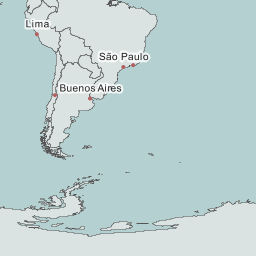
EOC Litemap (eoc:litemap)
This is the litemap provided for EOC Service Portals
TDM90 Amplitude Min (AMP) (TDM90_AMP)
TDM90 Amplitude Min (AMP)
DCM30 Date (DATE) - Last change 16-22 (TDM30_DCM_DATELAST)
DCM30 Date (DATE) - Last change 16-22
TDM90 Layover & Shadow Mask Mosaic (LSM) (TDM90_LSM)
TDM90 Layover & Shadow Mask Mosaic (LSM)
TDM90 Coverage Map (COV) (TDM90_COV)
TDM90 Coverage Map (COV)
TDM30 Editing Mask (EDM) (TDM30_EDEM_EDM)
TDM30 Editing Mask (EDM)
SoilSuite – Bare Surface Reflectance Composite - Standard deviation, Europe (SOILSUITE_SRC-STD_EUR_P5Y)
SoilSuite – Bare Surface Reflectance Composite - Standard deviation, Europe
World Relief B/W (eoc:world_relief_bw)
World Relief Black / White
TDM90 Consistency Map (COM) (TDM90_COM)
TDM90 Consistency Map (COM)
DCM30 DEM Change Maps (DCM) - Last change 16-22 (TDM30_DCM_DCMLAST)
DCM30 DEM Change Maps (DCM) - Last change 16-22
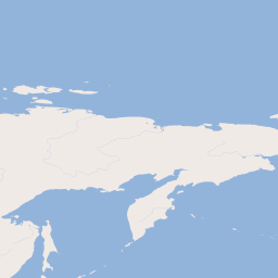
EOC Basemap (eoc:basemap)
This is the basemap for DLR Service Portals
EOC Baseoverlay (eoc:baseoverlay)
This is the baseoverlay for DLR Service Portals
DCM30 Height Accuracy Indication (HAI) - First change 16-22 (TDM30_DCM_HAIFIRST)
DCM30 Height Accuracy Indication (HAI) - First change 16-22
Hillshade (hillshade)
Global Hillshade based on GMTED2010
DCM30 Change Indication Mask (CIM) - First change 16-22 (TDM30_DCM_CIMFIRST)
DCM30 Change Indication Mask (CIM) - First change 16-22
TDM30 Land Cover Map (LCM) (TDM30_EDEM_LCM)
TDM30 Land Cover Map (LCM)
DCM30 Change Indication Mask (CIM) - Last change 16-22 (TDM30_DCM_CIMLAST)
DCM30 Change Indication Mask (CIM) - Last change 16-22
TDM30 Height Error Map (HEM) (TDM30_EDEM_HEM)
TDM30 Height Error Map (HEM)
MODIS EU DAILY (MODIS_EU_DAILY)
MODIS EU DAILY
TDM90 Water Indication Mask (WAM) (TDM90_WAM)
TDM90 Water Indication Mask (WAM)
GUF04_DLR_v1_Mosaic (scientific use only) (GUF04_DLR_v1_Mosaic)
GUF04_DLR_v1_Mosaic (scientific use only)
TDM90 Amplitude Min (AM2) (TDM90_AM2)
TDM90 Amplitude Min (AM2)
TDM30 Edited Digital Elevation Model (EDEM) EGM (TDM30_EDEM_EGM)
TDM30 Edited Digital Elevation Model (EDEM) EGM
DCM30 Height Accuracy Indication (HAI) - Last change 16-22 (TDM30_DCM_HAILAST)
DCM30 Height Accuracy Indication (HAI) - Last change 16-22
EOC Litemap (eoc:liteoverlay)
This is the liteoverlay provided for EOC Service Portals
Blue Marble NG with topo/bathy (bmng_topo_bathy)
Blue Marble NG dataset with topography and bathymetry
TDM30 Hill Shade Multidirectional (HSM) (TDM30_EDEM_HSM)
TDM30 Hill Shade Multidirectional (HSM)
DCM30 Date (DATE) - First change 16-22 (TDM30_DCM_DATEFIRST)
DCM30 Date (DATE) - First change 16-22
TDM90 Elevation (DEM) (TDM90_DEM)
TDM90 Elevation (DEM)
TDM30 Hill Shade Combined (HSC) (TDM30_EDEM_HSC)
TDM30 Hill Shade Combined (HSC)
DCM30 DEM Change Maps (DCM) - First change 16-22 (TDM30_DCM_DCMFIRST)
DCM30 DEM Change Maps (DCM) - First change 16-22
planet_eoc (planet_eoc)
OpenMapTiles processed by DLR/EOC
WSF3D_90m (WSF3D_90m)
World Settlement Footprint 3D (WSF3D) in 90m resolution
TDM30 Hill Shade Display (HSD) (TDM30_EDEM_HSD)
TDM30 Hill Shade Display (HSD)
TDM90 Height Error Map (HEM) (TDM90_HEM)
TDM90 Height Error Map (HEM)
There are currently no notifications for the service, click the feed icon to subscribe.