USGS-Core Science Systems -Biological … |
|
| Service health Now: |
|---|
- Interface
- Web Service, OGC Web Map Service 1.3.0
- Keywords
- Aquatic GAP HUC8 Hydrological Unit
- Fees
- None
- Access constraints
- None
- Supported languages
- No INSPIRE Extended Capabilities (including service language support) given. See INSPIRE Technical Guidance - View Services for more information.
- Data provider
-
USGS-Core Science Systems -Biological Informatics Program (unverified)
Contact information:
Andrea Ostroff
USGS-Core Science Systems -Biological Informatics Program
Physical:
12201 Sunrise Valley Drive MS 302 Reston, VA 20192-0002, 20192 Reston, USAEmail:
Phone: 703-648-4070
- Service metadata
- No INSPIRE Extended Capabilities (including service metadata) given. See INSPIRE Technical Guidance - View Services for more information.
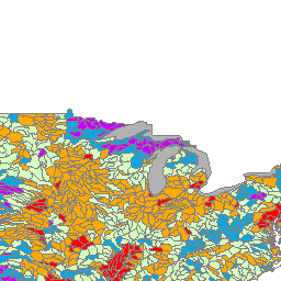
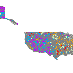
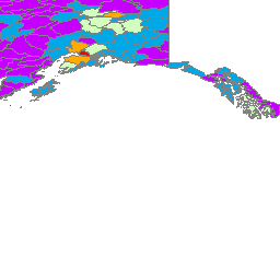
Hydrologic Unit: Watersheds in the United States and the Caribbean were delineated by the U.S. Geological Survey using a national standard hierarchical system based on surface hydrologic features and are classified into four types of hydrologic units: first-field (region), second-field (sub-region), third-field (accounting unit), and fourth-field (cataloguing unit). A fifth-field of classification (watershed) and sixth-field (sub-watershed) are currently under development. The United States and Caribbean are divided into 21 regions, 221 subregions, 378 accounting units, and 2,264 cataloguing units. A hydrologic unit can accept surface water directly from upstream drainage areas, and indirectly from associated surface areas such as remnant, non-contributing, and diversions to form a drainage area with single or multiple outlet points. Hydrologic units are only synonymous with classic watersheds when their boundaries include all the source area contributing surface water to a single defined outlet point. Hydrologic Unit Code: Each hydrologic unit is identified by a unique hydrologic unit code (HUC) consisting of two to twelve digits based on the six levels of classification: 8-digit HUC (Cataloguing Unit) 2-digit HUC first-level (region) 4-digit HUC second-level (subregion) 6-digit HUC third-level (accounting unit) 8-digit HUC fourth-level (cataloguing unit) 10-digit HUC fifth-level (watershed) 12-digit HUC sixth-level (subwatershed). This layer represents the 12-digit HUC sixth-level (subwatershed).
Available map layers (1)
NFHAP HCI Scores by Environmental Drainage Unit (EDU) (0)
NFHAP HCI Scores by Environmental Drainage Unit (EDU)