Agriculture and Agri-Food Canada |
|
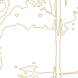
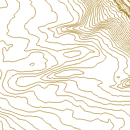
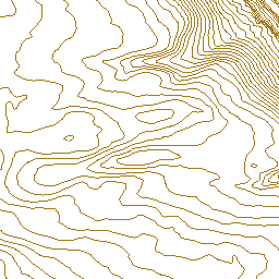
Swift Current LiDAR Project 2009
| Service health Now: |
|---|
- Interface
- Web Service, OGC Web Map Service 1.3.0
- Keywords
- Drainage, Remote sensing, Aerial photography, Floods, lang-en
- Fees
- unknown
- Access constraints
- © Government of Canada (2018). Data are subject to the Government of Canada Open Data Licence Agreement: http://open.canada.ca/en/open-government-licence-canada. The terms of this Agreement govern your use and reproduction of the data instead of the copyright reproduction statements found in Important Notices on the Agriculture and Agri-Food Canada website.
- Supported languages
- No INSPIRE Extended Capabilities (including service language support) given. See INSPIRE Technical Guidance - View Services for more information.
- Data provider
-
Agriculture and Agri-Food Canada (unverified)
Contact information:
Agri-Geomatics
Agriculture and Agri-Food Canada
Canada
Email:
- Service metadata
- No INSPIRE Extended Capabilities (including service metadata) given. See INSPIRE Technical Guidance - View Services for more information.
Ads by Google
Contour Lines generated from LiDAR data captured by McElhanney Consulting Services Ltd (MCSL). The contour lines connect points of equal elevation for the landscape covered by this project. For more information, visit: http://open.canada.ca/data/en/dataset/9bdc1a9c-baf7-4eb0-a532-c1057b284b8f
Available map layers (2)
Swift Current LiDAR Project 2009 - Contours (0)
5d6d7c6c-512c-42ce-9b96-77c3073933b6
Swift Current LiDAR Project 2009 - Bounded Area (1)
5d6d7c6c-512c-42ce-9b96-77c3073933b6
There are currently no notifications for the service, click the feed icon to subscribe.