Agriculture and Agri-Food Canada |
|
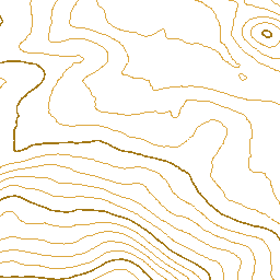
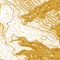
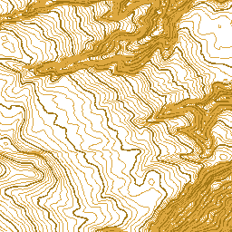
South Tobacco Creek Watershed - 10 cm Contours
| Service health Now: |
|---|
- Interface
- Web Service, OGC Web Map Service 1.3.0
- Keywords
- drainage, erosion, Canada, lang-en, Agriculture
- Fees
- unknown
- Access constraints
- © Government of Canada (2018). Data are subject to the Government of Canada Open Data Licence Agreement: http://open.canada.ca/en/open-government-licence-canada. The terms of this Agreement govern your use and reproduction of the data instead of the copyright reproduction statements found in Important Notices on the Agriculture and Agri-Food Canada website.
- Supported languages
- No INSPIRE Extended Capabilities (including service language support) given. See INSPIRE Technical Guidance - View Services for more information.
- Data provider
-
Agriculture and Agri-Food Canada (unverified)
Contact information:
Agri-Geomatics
Agriculture and Agri-Food Canada
Canada
Email:
- Service metadata
- No INSPIRE Extended Capabilities (including service metadata) given. See INSPIRE Technical Guidance - View Services for more information.
Ads by Google
The "South Tobacco Creek Watershed - 10 cm Contours" dataset is a linear representation of the LiDAR DEM data set to the closest 0.1 meters. For more information, visit: http://open.canada.ca/data/en/dataset/734078a9-9aa1-44a1-9e74-dc9387a9ecfe
Available map layers (2)
South Tobacco Creek Watershed - 10 cm Contours (0)
94bdc661-78b7-4fd3-a7f1-059fc119dfa8
South Tobacco Creek Watershed - Bounded Area (1)
94bdc661-78b7-4fd3-a7f1-059fc119dfa8
There are currently no notifications for the service, click the feed icon to subscribe.