National Renewable Energy Laboratory |
|
GeoServer Web Map Service
| Service health Now: |
|---|
- Interface
- Web Service, OGC Web Map Service 1.3.0
- Keywords
- WFS, WMS, GEOSERVER
- Fees
- NONE
- Access constraints
- NONE
- Supported languages
- No INSPIRE Extended Capabilities (including service language support) given. See INSPIRE Technical Guidance - View Services for more information.
- Data provider
-
National Renewable Energy Laboratory (unverified)
Contact information:
Anthony Lopez
National Renewable Energy Laboratory
Work:
80401 Golden,, USAEmail:
- Service metadata
- No INSPIRE Extended Capabilities (including service metadata) given. See INSPIRE Technical Guidance - View Services for more information.
Ads by Google
A compliant implementation of WMS plus most of the SLD extension (dynamic styling). Can also generate PDF, SVG, KML, GeoRSS
Available map layers (19)
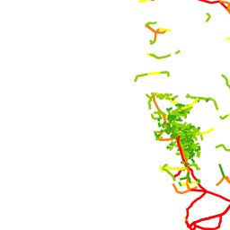
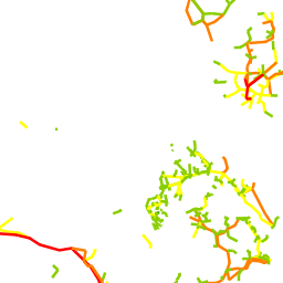
Africa Transmission Lines Existing Polylines AICD (africa_txline_existing08)
Africa Infrastructure Country Diagnostic (AICD) - http://www.infrastructureafrica.org/ The database is hosted by the African Development Bank. Data Sources Angola: IBRD map archive #23770, Apr 1992, & internet Benin: IBRD map archive #33246, #33245, Jun 2004. WAPP Member Utilities Performance report, 2005 Botswana: BPA 2006 Annual Report Burkina Faso: WB map archives IBRD #33253, Aug 2004. SONABEL website Burundi: "Reseau Electrique National", REGIDESO, undated hardcopy map Cameroon: "Reseau de Transport en Haute Tension Existant", AES SONEL c 2000 hardcopy map Cape Verde: IBRD map archive #30064, Mar 1999 Central African Republic: IBRD map archive #23036, Jun 1992 Chad: Data not available Comoros: Data not available Democratic Republic of Congo: IBRD map archive #35198, Apr 2007 Republic of Congo: IBRD map archive #28107, Jul 1996 Cote d'Ivoire: SOPIE website Djibouti: Data not available Equatorial Guinea: IBRD map archive #22885, Feb 1991. "OMVG Power System Development" WAPP undated hardcopy map Eritrea: Data not available Ethiopia: IBRD map archive #34623, April 2006 (hardcopy) Gabon: SEEG_Presentation_du_Situation_Energetique_du_Gabon.ppt Gambia, The: IBRD map archive #35062, Feb 2008; "OMVG Power System Development" WAPP undated hardcopy map Ghana: Solar and Wind Energy Resource Assessment (SWERA) Geospatial Toolkit (GsT) Guinea: IBRD map archive #34833, Jun 2006. WAPP Member Utilities Performance report, 2005 Guinea-Bissau: IBRD map archive #22885, Feb 1991 Kenya: IBRD map archive #33090, May 2004; SNC Lavalin Lesotho: "Lesotho Access to Electricity Study" UNDP/GEF Sep 2006 Liberia: IBRD map archive #35002, Feb 2008 Madagascar: IBRD map archive #34815, Jun 2006 Malawi: ESCOM Power System, undated hardcopy map Mali: IBRD map archive #36890, May 2009 Mauritania: OMVS undated hardcopy map Mauritius: Data not available Mayotte: Data not available Mozambique: IBRD map archive #32473, May 2003 Namibia: GISPrimaryConductorPath.shp downloaded from NamPower website, Sep 2009 Niger: IBRD map archive #35062; Feb 2008. Strategie d'Electrification Rurale, IED/CEH-SIDI Aug 2004 Nigeria: IBRD map archive #35062, Feb 2008 Reunion: Data not available Rwanda: IBRD map archive #33686, Nov 2004 Saint Helena: Data not available Sao Tome and Principe: Data not available Senegal: IBRD map archive #34462, Jan 2006 Seychelles: Data not available Sierra Leone: IBRD map archive #22273, Mar 1991. Bumbuna Hydroelectric Project Assessment EIA, 2005 Somalia: Data not available South Africa: Tx_Lines.shp provided by ESKOM, 2006 Sudan: IBRD map archive #32740, Jan 2004 Swaziland: IBRD map archive #19803, Jul 1986. "SEB Transmission System" with Motraco project, undated hardcopy map Tanzania: IBRD map archive #32473, May 2003 Togo: IBRD map archive #33246, #33245, Jun 2004. WAPP Member Utilities Performance report, 2005 Uganda: UGANDA-AERDP Final Report Annex 1, Feb 2004 Zambia: IBRD map archive #29233, Dec 1997 Zimbabwe: lines generated from map in ZESA Presentation on POWER GENERATION OPTIONS, SAPP website
Solar DNI Annual GeoTIFF Namibia 1km SolarGIS 2012 (dni_year_nam_tiled)
DNI Namibia (SolarGIS) Direct Normal Irradiation (c) 2012 GeoModel Solar http://solargis.info Annual Solar DNI Values. Units: kWh/m2/month Annual and monthly long-term average representing years 1994-2011.
Geomorphology Exclusion Grid EU MENA (eumena_geomorph)
Geomorphology exclusion of the EU and MENA regions.
Hydrography Grid EU MENA (eumena_hydrogr)
Hydrography of the EU and MENA regions.
Protected Areas Grid EU MENA (eumena_protect)
Protected area of the EU and MENA regions.
Urban Areas Grid EU MENA (eumena_urban)
Urban areas of the EU and MENA regions.
Land Cover GeoTIFF East Hemisphere GeoModel 2000 (glc00_east_tiled)
Global Land Cover 2000 (GLC2000) Global Land Cover 2000 © 2003 European Communities Resolution: 0:00:32.142857 Values / definition 1 evergreen broadleaved forests 2 deciduous broadleaved forests, closed (> 40%) 3 deciduous broadleaved forests, open (15-40%) 4 evergreen needle-leaved forest 5 deciduous needle-leaved forest 6 mixed forest 7 evergreen broadleaved - swamp forest 8 evergreen broadleaved - mangrove forest 9 mosaic - tree cover dominant with other vegetation component (natural, crop component) 10 burnt tree cover 11 evergreen shrubland 12 deciduous shrubland 13 grassland 14 sparsely vegetated cover 15 wetlands 16 croplands 17 mosaic - cropland dominant / tree cover, other natural vegetation 18 mosaic - cropland dominant / shrub, grass cover 19 bare areas 20 water bodies 21 snow and ice 22 artificial surfaces and associated areas 23 cover unknown, no data
Land Cover GeoTIFF West Hemisphere GeoModel 2000 (glc00_west_tiled)
Global Land Cover 2000 (GLC2000) Global Land Cover 2000 © 2003 European Communities Resolution: 0:00:32.142857 Values / definition 1 evergreen broadleaved forests 2 deciduous broadleaved forests, closed (> 40%) 3 deciduous broadleaved forests, open (15-40%) 4 evergreen needle-leaved forest 5 deciduous needle-leaved forest 6 mixed forest 7 evergreen broadleaved - swamp forest 8 evergreen broadleaved - mangrove forest 9 mosaic - tree cover dominant with other vegetation component (natural, crop component) 10 burnt tree cover 11 evergreen shrubland 12 deciduous shrubland 13 grassland 14 sparsely vegetated cover 15 wetlands 16 croplands 17 mosaic - cropland dominant / tree cover, other natural vegetation 18 mosaic - cropland dominant / shrub, grass cover 19 bare areas 20 water bodies 21 snow and ice 22 artificial surfaces and associated areas 23 cover unknown, no data
protected_areas (protected_areas)
Identified Hydrothermal Sites Points United States USGS 2008 (reatlas_geothermalpoint)
Identified hydrothermal sites from Assessment of Moderate- and High-Temperature Geothermal Resources of the United States (2008). This document summarizes the result of the resource assessment in which the identified sites in the data set were gathered and analyzed. The methodology used to develop resource estimates for the identified hydrothermal sites is available in A Review of Methods Applied by the U.S. Geological Survey in the Assessment of Identified Geothermal Resources. Site attributes list most likely values for temperature and reservoir volume and mean estimate for resource potential, taken from a distribution of values. Sources: - Williams, Colin F., Reed, Marshall J., Mariner, Robert H., DeAngelo, Jacob, Galanis, S. Peter, Jr., 2008, Assessment of moderate- and high-temperature geothermal resources of the United States: U.S. Geological Survey Fact Sheet 2008-3082, 4 p. - Williams, C.F., Reed, M.J., and Mariner, R.H., 2008, A review of methods applied by the U.S. Geological Survey in the assessment of identified geothermal resources: U.S. Geological Survey Open-File Report 2008-1296, 27 p.
Deep Enhanced Geothermal Systems Polygons United States SMU/NREL 2009 (reatlas_us_geothermal)
Map does not include shallow Deep Enhanced Geothermal Systems (EGS) resources located near hydrothermal sites or USGS assessment of undiscovered hydrothermal resources. Source data for deep EGS includes temperature at depth from 3 to 10 km provided by Southern Methodist University Geothermal Laboratory (Blackwell & Richards, 2009) and analyses (for regions with temperatures ≥150°C) performed by NREL (2009). N/A regions have temperatures less than 150°C at 10 km depth and were not assessed for deep EGS potential. Temperature at depth data for deep EGS in Alaska and Hawaii not available. Qualitative classes are based on temperature and depth ranges. Temperature values are not exclusive to any single class and may be located at different depths from one class to the next. Classes express approximate favorability for geothermal resource, with a lower number indicating the possibility of a higher potential value.
slope_reclass (slope_reclass)
Solar DNI Polygon Northern Africa SMA (sma_dni)
Solar DNI resources of Northern Africa.
Solar DNI Polygon Northern Africa SMA 1991-2005 (sma_match_1991-2005_dni)
Solar DNI Resource of Northern Africa.
Solar GHI Polygon Northern Africa SMA 1991-2005 (sma_match_1991-2005_ghi)
Solar GHI resource for Northern Africa.
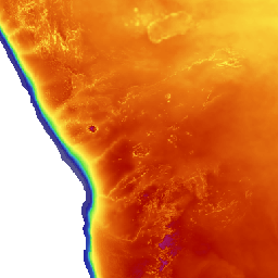
DEM GeoTIFF East Hemisphere Geomodel 2000-2006 (srtm30_e_tiled)
Elevation (SRTM-30) Shuttle Radar Topography Mission version 2 © 2000-2006 SRTM Mission SRTM30 plus © 2008 Joseph J. Becker, David T. Sandwell CleanTOPO2 © 2008 Tom Patterson Post-processing and cartography by GeoModel Solar Resolution: 00:00:30 Terrain maps show the elevation above sea level on the land and depth of the ocean and sea bottom. The slope inclination and azimuth are calculated on-the-fly. The map is developed from Shuttle Radar Topography Mission (SRTM) and SRTM Water Body Dataset (SWBD). The detailed SRTM3 data with grid resolution of 3 arcsec (~90 m at the equator) are available between the latitudes 60N and 50S, which represents the most of the continental parts of the Earth. For regions north from 60N and south from 50S, only the elevation data from GTOPO30 (SRTM30) are available. The original grid resolution of the GTOPO30 dataset is 30 arcsec (~1000 m at the equator). The bathymetry has been created from two different sources: SRTM30 plus dataset and CleanTOPO2 dataset, in which a few inconsitencies of SRTM30 plus are resolved. The fusion of these datasets has been done and the new map of bathymetry has been created. Terrain shading has been derived from GTOPO30 and SRTM-3 data.
DEM GeoTIFF West Hemisphere Geomodel 2000-2006 (srtm30_w_tiled)
Elevation (SRTM-30) Shuttle Radar Topography Mission version 2 © 2000-2006 SRTM Mission SRTM30 plus © 2008 Joseph J. Becker, David T. Sandwell CleanTOPO2 © 2008 Tom Patterson Post-processing and cartography by GeoModel Solar Resolution: 00:00:30 Terrain maps show the elevation above sea level on the land and depth of the ocean and sea bottom. The slope inclination and azimuth are calculated on-the-fly. The map is developed from Shuttle Radar Topography Mission (SRTM) and SRTM Water Body Dataset (SWBD). The detailed SRTM3 data with grid resolution of 3 arcsec (~90 m at the equator) are available between the latitudes 60N and 50S, which represents the most of the continental parts of the Earth. For regions north from 60N and south from 50S, only the elevation data from GTOPO30 (SRTM30) are available. The original grid resolution of the GTOPO30 dataset is 30 arcsec (~1000 m at the equator). The bathymetry has been created from two different sources: SRTM30 plus dataset and CleanTOPO2 dataset, in which a few inconsitencies of SRTM30 plus are resolved. The fusion of these datasets has been done and the new map of bathymetry has been created. Terrain shading has been derived from GTOPO30 and SRTM-3 data.
DEM GeoTIFF Eastern Africa Geomodel 2000-2006 (srtm_eapp2)
Elevation (SRTM-30) Shuttle Radar Topography Mission version 2 © 2000-2006 SRTM Mission SRTM30 plus © 2008 Joseph J. Becker, David T. Sandwell CleanTOPO2 © 2008 Tom Patterson Post-processing and cartography by GeoModel Solar Includes only Eastern African countries. Resolution: 00:00:30 Terrain maps show the elevation above sea level on the land and depth of the ocean and sea bottom. The slope inclination and azimuth are calculated on-the-fly. The map is developed from Shuttle Radar Topography Mission (SRTM) and SRTM Water Body Dataset (SWBD). The detailed SRTM3 data with grid resolution of 3 arcsec (~90 m at the equator) are available between the latitudes 60N and 50S, which represents the most of the continental parts of the Earth. For regions north from 60N and south from 50S, only the elevation data from GTOPO30 (SRTM30) are available. The original grid resolution of the GTOPO30 dataset is 30 arcsec (~1000 m at the equator). The bathymetry has been created from two different sources: SRTM30 plus dataset and CleanTOPO2 dataset, in which a few inconsitencies of SRTM30 plus are resolved. The fusion of these datasets has been done and the new map of bathymetry has been created. Terrain shading has been derived from GTOPO30 and SRTM-3 data.
RE_Atlas Solar Photovoltaic (us_solar_all_120512)
This data provides monthly average and annual average daily total solar resource averaged over surface cells of 0.1 degrees in both latitude and longitude, or about 10 km in size. The insolation values represent the resource available to fixed flat plate system tilted towards the equator at an angle equal to the latitude. The data are created using the SUNY Satellite Solar Radiation model (Perez, et.al., 2002). The data are averaged from hourly model output over 8 years (1998-2009). This model uses hourly radiance images from geostationary weather satellites, daily snow cover data, and monthly averages of atmospheric water vapor, trace gases, and the amount of aerosols in the atmosphere to calculate the hourly total insolation (sun and sky) falling on a horizontal surface. The direct beam radiation is then calculated using the atmospheric water vapor, trace gases, and aerosols, which are derived from a variety of sources. Where possible, existing ground measurement stations are used to validate the data. Source: Perez-SUNY/NREL, 2007 The data for Alaska was created using the Climatological Solar Radiation Model (Maxwell, George and Wilcox, 1998; George and Maxwell, 1999). This model uses information on cloud cover, atmospheric water vapor and trace gases, and the amount of aerosols in the atmosphere, to calculate the monthly average daily total insolation (sun and sky) falling on a horizontal surface. The cloud cover data used as input to the CSR model are an 8-year histogram (1985 - 1992) of monthly average cloud fraction provided for grid cells of approximately 40km x 40km in size. Thus, the spatial resolution of the CSR model output is defined by this database. The data were obtained from the National Climatic Data Center in Asheville, North Carolina, and were developed from the U.S. Air Force Real Time Nephanalysis (RTNEPH) program. Atmospheric water vapor, trace gases, and aerosols are derived from a variety of sources, as summarized in the references. The procedures for converting the modeled global horizontal insolation into the insolation received by a flat plate collector at latitude tilt are described in Marion and Wilcox (1994).
There are currently no notifications for the service, click the feed icon to subscribe.